Berrigan Accommodation, Hotels, Tours & Information
Places nearby Berrigan
- Albury
- Balldale
- Barham
- Barooga
- Bidgeemia
- Blighty
- Bowna
- Brassi
- Brocklesby
- Bulgandry
- Bungowannah
- Bunnaloo
- Buraja
- Burraboi
- Burrumbuttock
- Caldwell
- Calimo
- Conargo
- Coobool
- Coreen
- Corowa
- Corowa South
- Culcairn
- Cunninyeuk
- Daysdale
- Deniliquin
- Deniliquin North
- Dilpurra
- Echuca
- Ettamogah
- Finley
- Geraki
- Gerogery
- Gerogery West
- Goodnight
- Gulpa
- Henty
- Holbrook
- Howlong
- Hume Weir
- Jerilderie
- Jimaringle
- Jindera
- Koraleigh
- Kyalite
- Lalalty
- Lavington
- Lowesdale
- Mallan
- Mathoura
- Mayrung
- Mellool
- Moama
- Moira
- Morago
- Morven
- Moulamein
- Mullengandra
- Mulwala
- Nacurrie
- Niemur
- Noorong
- North Albury
- Oaklands
- Osborne
- Perekerten
- Pleasant Hills
- Pretty Pine
- Rand
- Rennie
- Ryan
- Savernake
- Speewa Island
- Springdale Heights
- St Johns
- Stony Crossing
- Table Top
- Tantonan
- Thule
- Thurgoona
- Tocumwal
- Tooleybuc
- Tueloga
- Tullakool
- Urana
- Urangeline East
- Wakool
- Walbundrie
- Walla Walla
- Wanganella
- Warragoon
- Wetuppa
- Wirlinga
- Womboota
- Woomargama
- Yallakool
Berrigan
Quiet traditional rural country town. Located 690 km south-west of Sydney via the Hume and Riverina highways and 119 m above sea level. The first settlers in the vicinity were small farmers who settled in the 1870s on land subdivided from the larger 'Barooga' and 'Boomanooma' stations which stretched from the Murray River up to the area of the present township of Barooga. Wool and wheat were early staples. The township grew up around the Berrigan Hotel, which opened in 1888 and is still operational. A commercial and service centre for the local farmers the village was proclaimed in 1890. The railway arrived in 1896. Although not the largest population centre it was declared the principal town of the newly declared shire in 1906, which took the town's name. Berrigan shire also incorporates Tocumwal, Barooga and Finley. The town has a strong interest in horse training and horseracing, particularly with the carnival atmosphere that prevails when the Berrigan Gold Cup is run. The town has a golf course and the annual district show is held early in October. About halfway along the road from Berrigan to Barooga is 'The Drop', where the Mulwala Canal crosses the road. There is a parking area to the right. This is part of a large water-flow control system which allows water to divert from Mulwala Canal into Berrigan Channel and is worth a look.

Berrigan Map
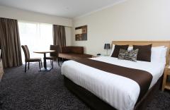
 Multiple Hotels
  Hotel
Hotel 

