Dangar Island Accommodation, Hotels, Tours & Information
Places nearby Dangar Island
- Avoca Beach North
- Bar Point
- Bateau Bay
- Bensville
- Berkeley Vale
- Blackwall
- Blue Bay
- Blue Haven
- Booker Bay
- Budgewoi
- Buff Point
- Calga
- Canton Beach
- Cedar Brush Creek
- Central Mangrove
- Chain Valley Bay
- Charmhaven
- Chittaway Bay
- Chittaway Point
- Cogra Bay
- Colongra
- Copacabana
- Daleys Point
- Davistown
- Dooralong
- Doyalson
- Empire Bay
- Erina
- Erina Heights
- Ettalong
- Ettalong Beach
- Forresters Beach
- Fountaindale
- Frazer Park
- Glenning Valley
- Gorokan
- Gosford
- Gosford East
- Gosford North
- Gosford South
- Gosford West
- Green Point
- Gwandalan
- Halekulani
- Hardys Bay
- Holgate
- Horsfield Bay
- Jilliby
- Kangy Angy
- Kanwal
- Kariong
- Killarney Vale
- Killcare
- Killcare Beach
- Killcare Heights
- Kincumber
- Kincumber South
- Koolewong
- Kulnura
- Lake Haven
- Lake Munmorah
- Lisarow
- Long Jetty
- Lower Mangrove
- Macmasters Beach
- Magenta
- Mangrove Creek
- Mangrove Mountain
- Mardi
- Matcham
- Milsons Passage
- Mooney Mooney
- Mount White
- Narara
- Niagara Park
- Norah Head
- Noraville
- Noraville/Norah Head
- Nords Wharf
- North Avoca
- Ourimbah
- Palmdale
- Patonga
- Patonga Beach
- Pearl Beach
- Peats Ridge
- Phegans Bay
- Picketts Valley
- Point Clare
- Point Frederick
- Pretty Beach
- Ravensdale
- Rocky Point
- San Remo
- Saratoga
- Shelly Beach
- Somersby
- Spencer
- Springfield
- St Huberts Island
- Tacoma
- Tascott
- Terrigal
- The Entrance
- The Entrance North
- Toowoon Bay
- Toukley
- Tuggerah
- Tuggerawong
- Tumbi Umbi
- Umina
- Umina Beach
- Upper Mangrove
- Wagstaffe
- Wamberal
- Warnervale
- Watanobbi
- Wendoree Park
- Woy Woy
- Woy Woy Bay
- Wyee
- Wyoming
- Wyong
- Wyong Creek
- Wyong North
- Wyongah
- Yarramalong
- Yattalunga
Dangar Island
Arguably Greater Sydney's most singular suburb, Dangar Island is simply remarkable.
Located off the eastern fringes of the Hawkesbury River hamlet of Brooklyn to the north of Sydney, Dangar Island lies in the middle of the Hawkesbury River atrium.
With its inimitable waterway surrounds, Dangar Island encapsulates the quintessential Hawkesbury River atmosphere. With Brisbane Water National Park to the north, Ku-ring Gai Chase National Park to the south, Broken Bay, the Pittwater and Pacific Ocean to the east, and the alluring Hawkesbury River to the west, Dangar Island and its beauty are captivating.
Just a short journey off the F3 freeway to Brooklyn, the island can only be accessed by water, via ferry, water taxi or private boat.
Rich in European and indigenous history, Dangar Island is a one-off environment and rewards visitors with some interesting photographic angles on one of the most significant waterways in the Sydney region.
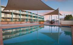
Great deals on hotels in Central Coast...

|
Bells at Killcare Boutique Hotel Restaurant and Spa - Killcare Heights  
From: A$559 More Info... |
|
Nesuto The Entrance Apartments - The Entrance  
From: A$262 More Info... |

|
Pretty Beach House - Pretty Beach 
From: A$1800 More Info... |
Dangar Island Map
 Multiple Hotels
  Hotel
Hotel 

