Beerburrum Accommodation, Hotels, Tours & Information
Places nearby Beerburrum
- Alexandra Headland
- Amamoor
- Aroona
- Bald Knob
- Banksia Beach
- Baroon Pocket
- Battery Hill
- Beerwah
- Bellara
- Belli Park
- Bells Bridge
- Bellthorpe
- Birtinya
- Black Mountain
- Bli Bli
- Bokarina
- Bongaree
- Booroobin
- Boreen Point
- Bribie Island
- Bridges
- Brooloo
- Buddina
- Buderim
- Burnside
- Burpengary
- Caboolture
- Calico Creek
- Caloundra
- Carters Ridge
- Cedar Pocket
- Cedarton
- Chatsworth
- Chevallum
- Conondale
- Cooloolabin
- Coolum Beach
- Coondoo
- Cooran
- Cooroy
- Cootharaba
- Corella
- Cotton Tree
- Curra
- Currimundi
- D'aguilar
- Delaneys Creek
- Dicky Beach
- Diddillibah
- Donnybrook
- Doonan
- Eerwah Vale
- Elanda Point
- Elgin Vale
- Elimbah
- Eudlo
- Eumundi
- Flaxton
- Forest Glen
- Glass House Mountains
- Glastonbury
- Glenview
- Godwin Beach
- Golden Beach
- Goomboorian
- Gregors Creek
- Gympie
- Harlin
- Highworth
- Hunchy
- Ilkley
- Image Flat
- Imbil
- Jimna
- Kandanga
- Kawana Waters
- Kenilworth
- Kiamba
- Kiels Mountain
- Kin Kin
- Kings Beach
- Kulangoor
- Kuluin
- Kunda Park
- Kureelpa
- Kybong
- Lagoon Pocket
- Landers Shoot
- Landsborough
- Langshaw
- Linville
- Little Mountain
- Makepeace Island
- Maleny
- Mapleton
- Marcoola
- Marcus Beach
- Maroochy River
- Maroochydore
- Maroochydore South
- Meldale
- Meridan Plains
- Minyama
- Moffat Beach
- Monkland
- Mons
- Montville
- Mooloolaba
- Mooloolah
- Mothar Mountain
- Mount Coolum
- Mount Mellum
- Mountain Creek
- Mudjimba
- Nambour
- Nambour West
- Neerdie
- Neurum
- Ninderry
- Ningi
- Noosa
- Noosa Heads
- Noosa North Shore
- Noosaville
- North Arm
- Pacific Paradise
- Palmview
- Palmwoods
- Parklands
- Parrearra
- Peachester
- Pelican Waters
- Peregian Beach
- Peregian Beach South
- Perwillowen
- Point Arkwright
- Pomona
- Rainbow Beach
- Reesville
- Sandstone Point
- Shelly Beach
- Sippy Downs
- Stanmore
- Stoney Creek
- Sunrise Beach
- Sunshine Beach
- Sunshine Coast
- Sunshine Coast (Maroochydore)
- Tamaree
- Tanawha
- Tandur
- Tewantin
- Tin Can Bay
- Tinbeerwah
- Toorbul
- Toorbul Point
- Towen Mountain
- Traveston
- Tuchekoi
- Twin Waters
- Valdora
- Veteran
- Villeneuve
- Warana
- Weyba Downs
- Witta
- Wolvi
- Woombye
- Woorim
- Wurtulla
- Yandina
- Yandina Creek
- Yaroomba
Beerburrum
A short detour off the Bruce Highway to Beerburrum on the way to the Sunshine Coast offers visitors the chance to soak up more than 80 years of local history thanks to the town's World War I Interpretive Signage. The interpretive signage, including old photographs, recognises Beerburrum's involvement with the soldier settlement scheme for Diggers who served in World War I. Around 500 blocks of land were allocated to returned servicemen, and 437 took up the offer and laid the foundation for the early growth of the towns along the rail corridor north from Brisbane. Don't miss Anzac Avenue and the Avenue of Trees planted in 1920. Signage information is also to be found nearby at Beerburrum State School, and the old Beerburrum Hospital. Beerburrum marks the start of the area surrounding the Glass House Mountains National Park and the many lookouts and walking trails to enjoy. Distance from Brisbane (State Capital): 59 kilometres.
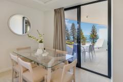
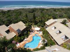
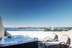
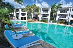
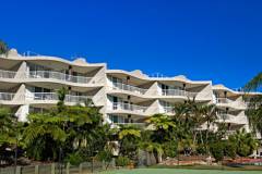
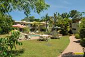
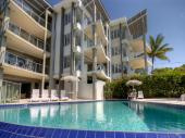
Great deals on hotels in Sunshine Coast...
|
Breeze Mooloolaba, an Ascend Hotel Collection member - Mooloolaba 
From: A$340 More Info... |

|
Culgoa Point Beach Resort - Noosa Heads 
From: A$534 More Info... |
|
Essence Peregian Beach - Peregian Beach 
From: A$509 More Info... |

|
First Light Mooloolaba - Mooloolaba 
From: A$393 More Info... |
|
Glen Eden Beach Resort - Peregian Beach 
From: A$320 More Info... |
|
Habitat Noosa - Elanda Point
From: A$266 More Info... |
|
Landmark Resort and Spa - Mooloolaba 
From: A$233 More Info... |

|
Misty View Cottages Montville - Montville 
From: A$617 More Info... |
|
Noosa Blue Resort - Noosa Heads 
From: A$312 More Info... |
|
Noosa Hill Resort - Noosa Heads
From: A$533 More Info... |
|
Noosa River Retreat - Noosaville
From: A$248 More Info... |
|
Rainbow Getaway Holiday Apartments - Rainbow Beach
From: A$257 More Info... |
|
Rainbow Ocean Palms - Rainbow Beach
From: A$371 More Info... |
|
Seaview Resort Mooloolaba - Mooloolaba
From: A$289 More Info... |

|
Spicers Clovelly Estate - Montville 
From: A$605 More Info... |

Beerburrum
Beerburrum Map
 Multiple Hotels
  Hotel
Hotel 

