Wakool Accommodation, Hotels, Tours & Information
Places nearby Wakool
- Albury
- Balldale
- Barham
- Barooga
- Berrigan
- Bidgeemia
- Blighty
- Bowna
- Brassi
- Brocklesby
- Bulgandry
- Bungowannah
- Bunnaloo
- Buraja
- Burraboi
- Burrumbuttock
- Caldwell
- Calimo
- Conargo
- Coobool
- Coreen
- Corowa
- Corowa South
- Culcairn
- Cunninyeuk
- Daysdale
- Deniliquin
- Deniliquin North
- Dilpurra
- Echuca
- Ettamogah
- Finley
- Geraki
- Gerogery
- Gerogery West
- Goodnight
- Gulpa
- Henty
- Holbrook
- Howlong
- Hume Weir
- Jerilderie
- Jimaringle
- Jindera
- Koraleigh
- Kyalite
- Lalalty
- Lavington
- Lowesdale
- Mallan
- Mathoura
- Mayrung
- Mellool
- Moama
- Moira
- Morago
- Morven
- Moulamein
- Mullengandra
- Mulwala
- Nacurrie
- Niemur
- Noorong
- North Albury
- Oaklands
- Osborne
- Perekerten
- Pleasant Hills
- Pretty Pine
- Rand
- Rennie
- Ryan
- Savernake
- Speewa Island
- Springdale Heights
- St Johns
- Stony Crossing
- Table Top
- Tantonan
- Thule
- Thurgoona
- Tocumwal
- Tooleybuc
- Tueloga
- Tullakool
- Urana
- Urangeline East
- Walbundrie
- Walla Walla
- Wanganella
- Warragoon
- Wetuppa
- Wirlinga
- Womboota
- Woomargama
- Yallakool
Wakool
The southern NSW border town of Wakool lies in irrigated country producing rice, wheat, barley and fat lambs. It is a true village supporting just the one pub, the one club and a cafe that peddles takeaways, basic groceries and, as a stand-in post office, stamps.
About halfway between Deniliquin and Barham, the region's settlement was initially forged by the railway in 1926, underwritten by the irrigation industry in the 1930s and sealed with a soldier settlement program in the wake of World War II. About 70 returned Diggers took up land when three large stations were split and a number of families of those original soldier-farmers still produce the district staple crops of rice and cereals.
Wakool is part of a shire of the same name which is administered from the central town of Moulamein. The Riverina shire covers more than 7500 sqkm of what used to be largely flood plain and Wakool is one of a chain of small towns lying within what is now described as the Golden Rivers Tourist Region.

Wakool Map
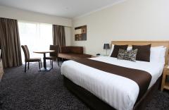
 Multiple Hotels
  Hotel
Hotel 

