Bowning Accommodation, Hotels, Tours & Information
Places nearby Bowning
- Ballalaba
- Bannister
- Baw Baw
- Bellmount Forest
- Bendick Murrell
- Berremangra
- Bevendale
- Biala
- Big Hill
- Bigga
- Binalong
- Binda
- Blakney Creek
- Blanket Flat
- Bombay
- Bookham
- Boorowa
- Boro
- Bradfordville
- Braidwood
- Brayton
- Breadalbane
- Bungendore
- Bungonia
- Burra Creek
- Burrinjuck
- Captains Flat
- Carrick
- Cavan
- Charleyong
- Chatsbury
- Collector
- Corang
- Crooked Corner
- Crookwell
- Crowther
- Cullerin
- Cunningar
- Currawang
- Curraweela
- Dalton
- Demondrille
- Eastgrove
- Fish River
- Frogmore
- Galong
- Garfield
- Gearys Gap
- Godfreys Creek
- Golspie
- Goodhope
- Goulburn
- Goulburn North
- Grabben Gullen
- Greenwich Park
- Gundaroo
- Gundillion
- Gunning
- Gurrundah
- Harden
- Hoskinstown
- Ifield
- Inveralochy
- Jembaicumbene
- Jerrabomberra
- Jerrawa
- Kain
- Karabar
- Kenmore
- Kialla
- Kingsdale
- Komungla
- Koorawatha
- Laggan
- Lake Bathurst
- Larbertouche
- Letchworth
- Lower Boro
- Majors Creek
- Manar
- Marulan
- Marulan South
- Mcalister
- Mcmahons Reef
- Monga
- Mongarlowe
- Mount Fairy
- Mount Rae
- Mummell
- Murrays Flats
- Murringo
- Murrumbateman
- Murrumburrah
- Myrtleville
- Narrawa
- Nerriga
- Oolong
- Oranmeir
- Parkesbourne
- Pejar
- Phils Creek
- Pomeroy
- Queanbeyan
- Queanbeyan East
- Redground
- Reids Flat
- Reidsdale
- Richlands
- Roslyn
- Royalla
- Rugby
- Strathaird
- Tallaganda
- Tallong
- Tarago
- Taralga
- Tarlo
- The Forest
- Thornford
- Tirrannaville
- Togganoggera
- Towrang
- Wallaroo
- Wamboin
- Wee Jasper
- Wheeo
- Windellama
- Wirrimah
- Woodhouselee
- Wowagin
- Yalbraith
- Yarra
- Yass
Bowning
Bowning is a small village situated 15kms from Yass on the Hume Highway. Hume and Hovell mentioned the landmark of Bowning Hill in their 1824 journal. The village of Bowning was one of the earliest settlements in the district, developing as it did because of its location on the Port Phillip Road, now known as the Hume Highway. The village grew during the laying of the railway in 1876, serviced town for supplies during building of Burrinjuck Dam. On the left as you enter Bowning from Yass is the Catholic Church. The stone for this church was laid on 24th October, 1909. A short distance on is St James Anglican Church, built in 1879. Other historic buildings include the モTroopers Cottageヤ on the Binalong Road and the old Cobb and Co Coaching Station on Bowning Road. The coaching station was built sometime between 1850 and 1870. The local school was amongst the earliest established schools in inland New South Wales. It was founded in 1849. The office administration building is original, though surrounded by new architecture. When the railway line came through in the 1870's, coaching inns declined. The introduction of a railway would have seen a rise in the population as fettlers made their homes in the village. Bowning Railway Station was built in 1876 and closed in 1992. The Commercial Hotel was built in the 1870's. On the outskirts of the village is Bowning Hill with an altitude of 796 metres above sea level. Reference was made to the outstanding landmark in the Journal of Hume and Hovell during the journey of exploration in 1824.
Great deals on hotels in Capital Country...
|
Mercure Goulburn - Goulburn 
From: A$178 More Info... |
|
Reflections Holiday Parks - Burrinjuck Waters Holiday Park - Bookham 
From: A$174 More Info... |
|
Reflections Holiday Parks - Grabine Lakeside Holiday Park - Bigga 
From: A$143 More Info... |
Bowning Map
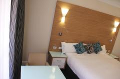
 Multiple Hotels
  Hotel
Hotel 

