St Marys Accommodation, Hotels, Tours & Information
Places nearby St Marys
- Alanvale
- Alberton
- Ansons Bay
- Apslawn
- Auburn
- Avoca
- Bacala
- Beaconsfield
- Beaumaris
- Beauty Point
- Beechford
- Bell Bay
- Bellingham
- Ben Lomond
- Binalong Bay
- Birralee
- Bishopsbourne
- Blackstone Heights
- Blackwall
- Blackwood Creek
- Blessington
- Blue Rocks
- Bracknell
- Branxholm
- Breadalbane
- Breona
- Bridgenorth
- Bridport
- Bronte Park
- Burns Creek
- Butlers Gorge
- Campbell Town
- Cape Barren Island
- Carrick
- Chain Of Lagoons
- Clarence Point
- Clarendon
- Cleveland
- Cluan
- Conara
- Cornwall
- Corra Linn
- Cressy
- Cuckoo
- Cullenswood
- Danbury Park
- Deddington
- Dee
- Delmont
- Deloraine
- Derby
- Deviot
- Devon Hills
- Diddleum Plains
- Dilston
- Douglas River
- Dunorlan
- East Launceston
- Elizabeth Town
- Elphin
- Emita
- English Town
- Epping Forest
- Evandale
- Exeter
- Exton
- Falmouth
- Fingal
- Flinders Island
- Flowery Gully
- Forester
- Four Mile Creek
- Frankford
- Franklin Village
- Frodsley
- George Town
- Gladstone
- Glendhu
- Glengarry
- Golconda
- Golden Valley
- Goshen
- Goulds Country
- Gravelly Beach
- Gray
- Greens Beach
- Grindelwald
- Hadspen
- Hagley
- Herrick
- Hillwood
- Hollow Tree
- Holwell
- Ilfraville
- Inveresk
- Invermay
- Jackeys Marsh
- Jetsonville
- Kamona
- Karoola
- Kayena
- Kelso
- Killiecrankie
- Kings Meadows
- Lackrana
- Lady Barron
- Lalla
- Lanena
- Launceston
- Launceston South
- Lebrina
- Lefroy
- Legana
- Legerwood
- Legunia
- Lietinna
- Liffey
- Lilydale
- Lisle
- Loccota
- Longford
- Lottah
- Low Head
- Lughrata
- Lulworth
- Mangana
- Mathinna
- Mayfield
- Meander
- Memana
- Miena
- Montana
- Moorina
- Mount Direction
- Mount Nicholas
- Mount William National Park
- Mowbray
- Mowbray Heights
- Musselboro
- Musselroe Bay
- Myrtle Bank
- Nabowla
- Needles
- Newnham
- Newstead
- Nile
- Norwood
- Notley Hills
- Nunamara
- Oaks
- Ormley
- Osmaston
- Osterley
- Palana
- Paper Beach
- Parkham
- Pateena
- Patersonia
- Perth
- Pioneer
- Pipe Clay Bay
- Pipers Brook
- Pipers River
- Poatina
- Powranna
- Priory
- Prospect
- Prospect Vale
- Punchbowl
- Pyengana
- Quamby Brook
- Ranga
- Ravenswood
- Red Hills
- Reedy Marsh
- Relbia
- Retreat
- Richmond Hill
- Ringarooma
- Riverside
- Robigana
- Rocherlea
- Roses Tier
- Rosevale
- Rosevears
- Rossarden
- Rowella
- Sandhill
- Scamander
- Scottsdale
- Selbourne
- Seymour
- Shannon
- Sidmouth
- South Mount Cameron
- St Helens
- St Leonards
- Steiglitz
- Steppes
- Storys Creek
- Strickland
- Summerhill
- Targa
- Tarraleah
- Tasmania North Central
- Tayene
- Telita
- Toiberry
- Tomahawk
- Tonganah
- Tower Hill
- Trenah
- Trevallyn
- Tulendeena
- Tullochgorum
- Tunnel
- Turners Marsh
- Underwood
- Upper Esk
- Victoria Valley
- Waddamana
- Warrentinna
- Waterhouse
- Waverley
- Wayatinah
- Weetah
- Weldborough
- West Launceston
- Westbury
- Western Junction
- Westwood
- Weymouth
- White Hills
- Whitemark
- Whitemore
- Wihareja
- Windemere
- Windermere
- Winkleigh
- Winnaleah
- Wyena
- York Town
- Youngtown
St Marys
St Marys, New South Wales Australia, is located on the eastern side of the Penrith Local Government Area. Its western boundary is South Creek with the M4 Motorway as its southern boundary. Mardsen Road and Sydney Street divides this suburb from the smaller suburbs of Colyton and Oxley Park on its western boundary. Its northern section takes in the previously named industrial suburb of Dunheved. St Marys has a long and rich industrial and agricultural history including tanneries and munitions. The area which is now the suburb is much reduced from its historical perspective known as St Marys. This suburb is the major industrial, commercial and residential centre for the eastern side of the local government area. This suburb services many rural and urban communities, making it a vital part of the City of Penrith. For visitor information on St Marys please contact the Penrith Valley Visitor Information Centre: www.penrithvalley.com.au 1300 736 836
Great deals on hotels in Launceston/Nth East...
|
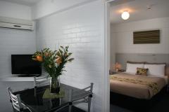
Adina Place Motel Apartments - Launceston 
From: A$206 More Info... |
|
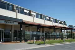
Bayside Hotel - St Helens 
From: A$173 More Info... |
|
Best Western Plus Launceston - Launceston   
From: A$208 More Info... |

|
Elphin Motel & Serviced Apartments - Launceston
From: A$175 More Info... |
|
Georges Bay Apartments - St Helens 
From: A$194 More Info... |

|
Hotel Verge Launceston - Launceston 
From: A$234 More Info... |
|
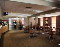
Nightcap at Riverside Hotel - Launceston
From: A$185 More Info... |
|
Panorama Hotel St Helens - St Helens
From: A$220 More Info... |
|
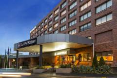
Quality Hotel Colonial Launceston - Launceston
From: A$179 More Info... |
|
Scamander Beach Resort - Scamander
From: A$163 More Info... |

St Marys


St Marys Map
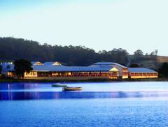
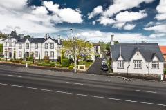
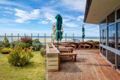
 Multiple Hotels
  Hotel
Hotel 

