Rupanyup Accommodation, Hotels, Tours & Information
Places nearby Rupanyup
- Antwerp
- Apsley
- Arapiles
- Ararat
- Arkona
- Armstrong
- Ashens
- Avon Plains
- Awonga
- Balmoral
- Balrootan North
- Banyena
- Barton
- Bellellen
- Bellfield Settlement
- Benayeo
- Berrambool
- Birchip
- Black Range
- Blackheath
- Bleak House
- Bolangum
- Booroopki
- Boyeo
- Bridge Inn
- Brimpaen
- Bringalbert
- Brit Brit
- Brooksby
- Bulart
- Bungalally
- Burrereo
- Byrneville
- Callawadda
- Campbells Bridge
- Cannum
- Carapook
- Carpolac
- Cathcart
- Cavendish
- Charam
- Cherrypool
- Chetwynd
- Clear Lake
- Clover Flat
- Coleraine
- Connangorach
- Connewirricoo
- Coojar
- Coromby
- Dadswells Bridge
- Dahlen
- Dart Dart
- Deep Lead
- Denicull Creek
- Diapur
- Dimboola
- Dobie
- Dooen
- Dopewarra
- Douglas
- Drung Drung
- Dunkeld
- Edenhope
- Englefield
- Fyans Creek
- Garup
- Gatum
- Gerang Gerung
- Glenisla
- Glenlee
- Glenorchy
- Glenthompson
- Goroke
- Grampians
- Grass Flat
- Great Western
- Green Lake
- Gringegalgona
- Gritjurk
- Gymbowen
- Halls Gap
- Hamilton
- Hamilton North
- Harrow
- Haven
- Hensley Park
- Henty
- Hilgay
- Horsham
- Horsham West
- Illawarra
- Jallukar
- Jallumba
- Jerro
- Jung
- Kadnook
- Kalkee
- Kanagulk
- Kanawalla
- Kangawall
- Karabeal
- Karnak
- Katyil
- Kewell
- Kia Ora
- Kiata
- Kinimakatka
- Laen
- Laharum
- Lake Bolac
- Lake Lonsdale
- Langi Logan
- Langkoop
- Lawler
- Lawloit
- Ledcourt
- Longerenong
- Lubeck
- Mafeking
- Marnoo
- Maroona
- Mckenzie Creek
- Melville Forest
- Merino
- Miga Lake
- Minimay
- Mininera
- Minyip
- Mirranatwa
- Mitre
- Mockinya
- Mokepilly
- Mooralla
- Morea
- Moree
- Mortat
- Mount Elgin
- Moutajup
- Moyston
- Murra Warra
- Murtoa
- Nareen
- Natimuk
- Nerrin Nerrin
- Nhill
- Noradjuha
- Norval
- Nullan
- Nurcoung
- Nurrabiel
- Ozenkadnook
- Paschendale
- Patyah
- Peronne
- Pigeon Ponds
- Pimpinio
- Pomonal
- Poolaijelo
- Powers Creek
- Propodollah
- Pura Pura
- Quantong
- Raluana
- Remlaw
- Rhymney Reef
- Riachella
- Riverside
- Rocklands
- Roses Gap
- Rossbridge
- Salisbury
- Serviceton
- Sheep Hills
- St Helens Plains
- Stavely
- Stawell
- Stawell West
- Strathkellar
- Streatham
- Tahara
- Tahara Bridge
- Tahara West
- Tallageira
- Tarranginnie
- Tarrayoukyan
- Tarrenlea
- Tarrington
- Tatyoon
- Telangatuk
- Tooan
- Toolondo
- Ullswater
- Vasey
- Vectis
- Victoria Valley
- Wail
- Wal Wal
- Wallaloo
- Wallup
- Wannon
- Warrayure
- Wartook
- Watgania
- Westmere
- Wickliffe
- Willaura
- Winiam
- Wombelano
- Wonwondah East
- Wonwondah North
- Wonwondah South
- Woohlpooer
- Woorak
- Wootong Vale
- Wycheproof
- Yarram Park
- Yatchaw
- Youngvale
- Yulecart
Rupanyup
Taking its name from the local Aboriginal for 'a tree at a campsite near a swamp', Rupanyup is a small attractive town 285km north-west of Melbourne.
The town was started in 1870 by British and German land selectors who had a long running-battle with Murtoa settlers over who had stronger claims to leadership over the Dunmunkle Shire. In fact, at one stage the Rupanyum burghers accused their Murtoa counterparts of stealing their town hall.
The feud finally ended when Dunmunkle was absorbed into the Yarriambiack Shire and Warracknambeal was declared the administrative centre.
Rupanyup's pride is the restored Cromie Road streetscape which includes garden boxes, shade trees, pergolas, a walkway and a replica of the town's first store, opened by William Cust in 1872.
Whistlestoppers can stretch their legs in a Lions Club Park at the northern end of the township. The park features gardens, lawns, picnic and barbecue facilities.
Great deals on hotels in Grampians...
|
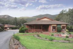
Country Plaza Halls Gap - Halls Gap 
From: A$194 More Info... |

|
DULC Cabins - Halls Gap 
From: A$503 More Info... |
|
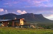
Meringa Springs - Wartook 
From: A$744 More Info... |
|
Mount William Station - Willaura   
From: A$140 More Info... |
Rupanyup Map
 Multiple Hotels
  Hotel
Hotel 

