Chelmer Accommodation, Hotels, Tours & Information
Places nearby Chelmer
- Anstead
- Auchenflower
- Bardon
- Bardon West
- Barellan Point
- Basin Pocket
- Bellbird Park
- Bellbowrie
- Blacksoil
- Blackstone
- Blenheim
- Booval
- Borallon
- Brassall
- Brassall Heights
- Brightview
- Brisbane Forest Park
- Brookfield
- Buaraba
- Bundamba
- Bunya
- Bunya Mountains
- Calvert
- Chapel Hill
- Churchill
- Chuwar
- Cleveland
- Coalfalls
- Collingwood Park
- Coolana
- Coominya
- Dinmore
- Eastern Heights
- Ebbw Vale
- Ebenezer
- Fernvale
- Fig Tree Pocket
- Flinders View
- Forest Hill
- Gailes
- Gatton
- Glamorgan Vale
- Glenore Grove
- Goodna
- Goodna East
- Grantham
- Haigslea
- Indooroopilly
- Jamboree Heights
- Jindalee
- Karalee
- Karana Downs
- Karrabin
- Kedron
- Kenmore
- Kenmore East
- Kenmore Hills
- Kentville
- Kholo
- Laidley
- Lake Clarendon
- Lawes
- Leichhardt
- Loamside
- Lockrose
- Logan Village
- Lowood
- Ma Ma Creek
- Marburg
- Middle Park
- Minden
- Moggill
- Moores Pocket
- Mount Berryman
- Mount Coot-Tha
- Mount Crosby
- Mount Ommaney
- Mount Tarampa
- Mulgowie
- Newtown
- North Booval
- North Ipswich
- Oxley
- Pine Mountain
- Pinjarra Hills
- Plainland
- Prenzlau
- Pullenvale
- Purga
- Rainworth
- Raymonds Hill
- Redbank
- Redbank Plains
- Redland Bay
- Ripley
- Riverhills
- Riverview
- Ropeley
- Rosewood
- Sadliers Crossing
- Seventeen Mile Rocks
- Silkstone
- Sinnamon Park
- Sumner
- Swanbank
- Tallegalla
- Tarampa
- Taringa
- Thagoona
- The Gap
- Tivoli
- Toowong
- Upper Brookfield
- Upper Kedron
- Wacol
- Walloon
- West Ipswich
- Westlake
- Willowbank
- Woodend
- Wulkuraka
- Yamanto
Chelmer
Wandering by water-encircled Chelmer's neat homes set back from tree-lined streets, it is difficult to imagine that this solidly middle-class suburb was once part of a chain of sugar plantations that dominated both banks of the Brisbane River on the south-eastern fringes of the fledgling Queensland capital city.
Colonial Brisbane's flourishing cane industry, however, was brought to its knees by a succession of freakishly cold winters in the 1870s which forced farmers to turn to dairy farming and mixed crops for their livelihood.
As the population grew and demand for houses mounted, sub-division of the farm holdings along this part of the river began in the 1880s.
Today's residents take intense pride in their suburb and Laurel Avenue was voted the best street in Brisbane in 1999. A couple of Chelmer"s parks are on the banks of the Brisbane River and one, Taylor Bridge Reserve, offers playground, picnicking and BBQ facilities.


Chelmer Map
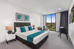
 Multiple Hotels
  Hotel
Hotel 

