Camooweal Accommodation, Hotels, Tours & Information
Places nearby Camooweal
- Aramac
- Augathella
- Barcaldine
- Bedarra Island
- Bedourie
- Birdsville
- Blackall
- Bollon
- Boulia
- Breakaway
- Bundaberg
- Bushy Park
- Charleville
- Cheepie
- Chillagoe
- Claverton
- Clear Mountain
- Cloncurry
- Cooladdi
- Corfield
- Cunnamulla
- Dajarra
- Duchess
- Eromanga
- Eulo
- Grandchester
- Healy
- Hughenden
- Hungerford
- Ilfracombe
- Isisford
- Jericho
- Julia Creek
- Jundah
- Kajabbi
- Kinka Beach
- Kynuna
- Lamington
- Lamington National Park
- Longreach
- Mary Kathleen
- Maxwelton
- McKinlay
- Menzies
- Mica Creek
- Miles End
- Mitchell
- Moranbah
- Morella
- Morven
- Mount Isa
- Mount Isa East
- Mt Isa
- Mulambin
- Muttaburra
- Nelia
- Noccundra
- Nonda
- Oorindi
- Prairie
- Quilpie
- Richmond
- Ryan
- Saltern
- Soldiers Hill
- Springsure
- Stamford
- Stonehenge
- Sunset
- Tambo
- Thargomindah
- The Monument
- Torrens Creek
- Townview
- Windorah
- Winston
- Winton
- Wyandra
- Yalleroi
- Yaraka
Camooweal
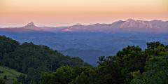
Camooweal is located on the Queensland-Northern Territory border, 330 kilometres south of Burketown, 188 kilometres from Mount Isa and 440 kilometres from the Stuart Highway in the Northern Territory. Camooweal proudly declares itself 'Gateway to the Northern Territory/Queensland'. The road from Mount Isa to the town, known to locals as 'Tojo's Highway', was built during World War II with American funds and was originally designed as a link between the southern states and the theoretical 'front line' in the Northern Territory. The explorer William Landsborough was the first European to pass through the Camooweal area. At the time (1862) he was looking for Burke and Wills. His reports led to the area being settled by pastoralists but it wasn't until 1884 that the town of Camooweal was gazetted. It grew as a service centre for the surrounding properties but the growth of Mount Isa meant sustained growth was not possible. Camooweal is now considered a 'suburb' of Mount Isa, such is the vastness of the region, and the huge jurisdiction the Mount Isa City Council operates. The Barkly Highway between Mount Isa and Camooweal is considered the longest main street in the world at 188 kilometres long! The Camooweal district is honeycombed with rare sink holes and caves, dating back to the Cambrian Period, about 500 million years ago. Those visitors experienced in serious caving will discover a whole new world beneath the Camooweal region. While in Cammoweal visit The Barkly Tableland Heritage Centre, Freckleton's Store, Cammoweal Caves National Park, Camooweal Cemetery and the Drovers Camp Information Centre.
Great deals on hotels in Regional QLD...
|
Mitchell Grass Retreat Longreach - Longreach  
From: A$385 More Info... |
|
O'Reilly's Rainforest Retreat - Lamington National Park   
From: A$289 More Info... |
|
Rangelands Outback Camp - Winton 
From: A$1195 More Info... |

|
Saltbush Retreat - Longreach 
From: A$199 More Info... |
|
Spicers Hidden Vale - Grandchester 
From: A$615 More Info... |
|
Toogunna Plains Farmstay - Quilpie 
From: A$185 More Info... |

Camooweal


Camooweal Map
 Multiple Hotels
  Hotel
Hotel 

