Windorah Accommodation, Hotels, Tours & Information
Places nearby Windorah
- Aramac
- Augathella
- Barcaldine
- Bedarra Island
- Bedourie
- Birdsville
- Blackall
- Bollon
- Boulia
- Breakaway
- Bundaberg
- Bushy Park
- Camooweal
- Charleville
- Cheepie
- Chillagoe
- Claverton
- Clear Mountain
- Cloncurry
- Cooladdi
- Corfield
- Cunnamulla
- Dajarra
- Duchess
- Eromanga
- Eulo
- Grandchester
- Healy
- Hughenden
- Hungerford
- Ilfracombe
- Isisford
- Jericho
- Julia Creek
- Jundah
- Kajabbi
- Kinka Beach
- Kynuna
- Lamington
- Lamington National Park
- Longreach
- Mary Kathleen
- Maxwelton
- McKinlay
- Menzies
- Mica Creek
- Miles End
- Mitchell
- Moranbah
- Morella
- Morven
- Mount Isa
- Mount Isa East
- Mt Isa
- Mulambin
- Muttaburra
- Nelia
- Noccundra
- Nonda
- Oorindi
- Prairie
- Quilpie
- Richmond
- Ryan
- Saltern
- Soldiers Hill
- Springsure
- Stamford
- Stonehenge
- Sunset
- Tambo
- Thargomindah
- The Monument
- Torrens Creek
- Townview
- Winston
- Winton
- Wyandra
- Yalleroi
- Yaraka
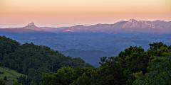
Windorah
With a panorama of giant red sandhills, Windorah is located in the heart of the Channel Country, beside Cooper's Creek. It doesn't get much more 'outback' than here, with its stunning vistas, picturesque ruins and historical sites. Windorah's history is linked with Isisford for it was the Whitman brothers who established both towns. Originally known as Stony Point, its current name is the Aboriginal word for 'place of large fish'. This relates to Cooper's Creek, which is formed by the junction of the Thomson and Barcoo Rivers just south of Jundah. Cooper Creek at Windorah is a top fishing spot, ideal for birdwatching and enjoying watersports with a waterhole about 19 kilometres in length and up to 10 metres deep. The channels can spread floodwaters up to 100 kilometres wide as they flow towards Lake Eyre. A scenic 12 kilometre nature drive from town to Cooper's Creek gives a view of the area with all its diversity. Magnificent red sandhills are situated just to the west of town. Windorah's main industry is cattle grazing, due to the abundance of Mitchell Grass and other herbage that is available especially after floods.
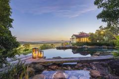
Great deals on hotels in Regional QLD...
|
Mitchell Grass Retreat Longreach - Longreach  
From: A$385 More Info... |
|
O'Reilly's Rainforest Retreat - Lamington National Park   
From: A$289 More Info... |
|
Rangelands Outback Camp - Winton 
From: A$1195 More Info... |

|
Saltbush Retreat - Longreach 
From: A$199 More Info... |
|
Spicers Hidden Vale - Grandchester 
From: A$615 More Info... |
|
Toogunna Plains Farmstay - Quilpie 
From: A$185 More Info... |

Windorah


Windorah Map
 Multiple Hotels
  Hotel
Hotel 

