Springsure Accommodation, Hotels, Tours & Information
Places nearby Springsure
- Aramac
- Augathella
- Barcaldine
- Bedarra Island
- Bedourie
- Birdsville
- Blackall
- Bollon
- Boulia
- Breakaway
- Bundaberg
- Bushy Park
- Camooweal
- Charleville
- Cheepie
- Chillagoe
- Claverton
- Clear Mountain
- Cloncurry
- Cooladdi
- Corfield
- Cunnamulla
- Dajarra
- Duchess
- Eromanga
- Eulo
- Grandchester
- Healy
- Hughenden
- Hungerford
- Ilfracombe
- Isisford
- Jericho
- Julia Creek
- Jundah
- Kajabbi
- Kinka Beach
- Kynuna
- Lamington
- Lamington National Park
- Longreach
- Mary Kathleen
- Maxwelton
- McKinlay
- Menzies
- Mica Creek
- Miles End
- Mitchell
- Moranbah
- Morella
- Morven
- Mount Isa
- Mount Isa East
- Mt Isa
- Mulambin
- Muttaburra
- Nelia
- Noccundra
- Nonda
- Oorindi
- Prairie
- Quilpie
- Richmond
- Ryan
- Saltern
- Soldiers Hill
- Stamford
- Stonehenge
- Sunset
- Tambo
- Thargomindah
- The Monument
- Torrens Creek
- Townview
- Windorah
- Winston
- Winton
- Wyandra
- Yalleroi
- Yaraka
Springsure
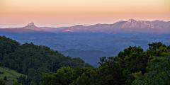
Springsure is located on the Gregory Highway section of the Great Inland Way, 66 kilometres south of Emerald and is the main centre for Bauhinia Shire. The town derived its name from the permanent springs in the creek and gullies at the time of settlement in the area. The town developed primarily from the early wagon teams camping on their way from Rockhampton to the Gulf and Barcoo country. The Staircase Range Cutting, built in 1905 by Chinese labour, pays tribute to the early wagon trails, once the lifeblood for the township. the Staircase Range itself is a sandstone escarpment that has naturally formed into the shape of a staircase. Sitting in a delightful valley with spectacular Mount Zamia and the famous Virgin Rock overlooking the town, Springsure is home to the Zamia Parklands that incorporates the Rich Park Historical Complex, the heritage listed 1868 hospital and Bauhinia Shire Art Gallery. Old Rainworth Fort, just south of town, was built in 1862 as protection against aboriginal attack. The fort was fireproof and very nearly impregnable, being constructed of basalt blocks and corrugated iron. Take time to walk through the Cairdbeign Homestead and School, which houses relics from the period. Day permits are available to fossick for opalised wood at 'Marmadilla' and labradorite at 'cardbeign'. Ask at Macs Cafe.
Great deals on hotels in Regional QLD...
|
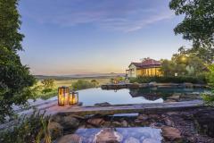
Mitchell Grass Retreat Longreach - Longreach  
From: A$385 More Info... |
|
O'Reilly's Rainforest Retreat - Lamington National Park   
From: A$289 More Info... |
|
Spicers Hidden Vale - Grandchester 
From: A$619 More Info... |
|
Toogunna Plains Farmstay - Quilpie 
From: A$189 More Info... |

Springsure


Springsure Map
 Multiple Hotels
  Hotel
Hotel 

