Booborowie Accommodation, Hotels, Tours & Information
Places nearby Booborowie
- Alma
- Andrews
- Appila
- Ardrossan
- Arthurton
- Auburn
- Australia Plains
- Avon
- Balaklava
- Balgowan
- Bangor
- Barabba
- Belalie
- Bethel
- Bibaringa
- Black Rock
- Black Springs
- Blyth
- Booleroo Centre
- Bower
- Bowillia
- Bowmans
- Brentwood
- Brinkworth
- Brownlow
- Burra
- Burra North
- Bute
- Calomba
- Caltowie
- Clare
- Coobowie
- Corny Point
- Crystal Brook
- Cunliffe
- Curramulka
- Dawson
- Dublin
- Edithburgh
- Emu Downs
- Eudunda
- Eurelia
- Everard
- Farrell Flat
- Foul Bay
- Frankton
- Freeling
- Gawler
- Gawler East
- Gawler River
- Gawler South
- Gawler West
- Georgetown
- Giles Corner
- Gladstone
- Gulnare
- Halbury
- Hallett
- Hamilton
- Hamley Bridge
- Hampden
- Hardwicke Bay
- Hart
- Hilltown
- Hoyleton
- Jamestown
- Julia
- Kadina
- Kapunda
- Koolunga
- Koonunga
- Korunye
- Kulpara
- Kybunga
- Lake View
- Laura
- Leasingham
- Lochiel
- Long Plains
- Lower Light
- Maitland
- Mallala
- Manoora
- Marion Bay
- Marrabel
- Melton
- Merriton
- Minlaton
- Mintaro
- Moculta
- Moonta
- Moonta Bay
- Moonta Mines
- Morchard
- Mount Bryan
- Mount Mary
- Mundoora
- Murray Town
- Nackara
- Nantawarra
- Napperby
- Narridy
- Neales Flat
- Nelshaby
- North Yelta
- Oaklands
- Oodla Wirra
- Orroroo
- Owen
- Paskeville
- Pekina
- Penong
- Penwortham
- Pine Point
- Pinery
- Point Pass
- Point Pearce
- Point Turton
- Port Broughton
- Port Hughes
- Port Julia
- Port Parham
- Port Pirie
- Port Victoria
- Port Vincent
- Port Wakefield
- Price
- Red Banks
- Redhill
- Reeves Plains
- Rhynie
- Riverton
- Robertstown
- Roseworthy
- Saddleworth
- Salter Springs
- Sandilands
- Sevenhill
- Snowtown
- Solomontown
- South Kilkerran
- Spalding
- Stansbury
- Stenhouse Bay
- Stockport
- Stockwell
- Stone Hut
- Stonefield
- Sutherlands
- Tarcowie
- Tarlee
- Tarnma
- Terowie
- Tickera
- Truro
- Urania
- Wallaroo
- Wallaroo Mines
- Wandearah
- Wandearah East
- Warnertown
- Warooka
- Wasleys
- Waterloo
- Watervale
- Weetulta
- Whyte Yarcowie
- Wild Horse Plains
- Willaston
- Windsor
- Wirrabara
- Wool Bay
- Yacka
- Yatina
- Yongala
- Yorketown
Booborowie
Deep in sheep territory in the state's mid-north, Booborowie lies on the Barrier Highway, about halfway between Spalding and Burra.
Apart from stud merinos, the region also produces grain, canola, lucerne and clover seed. A one-hotel town, Boororowie is blessed with fine sporting facilities, including a swimming pool, while the one-stop store caters for grocery, hardware and postal needs.
A short drive north-west takes the traveller to Geralka Farm. This working farm, which runs more than 2000 sheep, gives the visitor the chance to see working Clydesdale horses and old machinery which helped break in the regional farming land.
A half hour"s drive to the south-east takes you one of the icons on the South Australian heritage calendar, Burra. Burra"s elevation in 1994 to State Heritage status backs the town"s long established claims as "an historic copper town" and the "merino capital of the world".
Great deals on hotels in Clare/Yorke Penin....
|
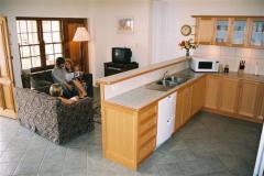
Bungaree Station - Clare  
From: A$220 More Info... |
|
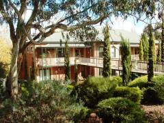
Clare Country Club - Clare 
From: A$296 More Info... |
|
Redwing Barn and Redwing Shearer's Quarters - Weetulta 
From: A$259 More Info... |
Booborowie Map
 Multiple Hotels
  Hotel
Hotel 

