Hamley Bridge Accommodation, Hotels, Tours & Information
Places nearby Hamley Bridge
- Alma
- Andrews
- Appila
- Ardrossan
- Arthurton
- Auburn
- Australia Plains
- Avon
- Balaklava
- Balgowan
- Bangor
- Barabba
- Belalie
- Bethel
- Bibaringa
- Black Rock
- Black Springs
- Blyth
- Booborowie
- Booleroo Centre
- Bower
- Bowillia
- Bowmans
- Brentwood
- Brinkworth
- Brownlow
- Burra
- Burra North
- Bute
- Calomba
- Caltowie
- Clare
- Coobowie
- Corny Point
- Crystal Brook
- Cunliffe
- Curramulka
- Dawson
- Dublin
- Edithburgh
- Emu Downs
- Eudunda
- Eurelia
- Everard
- Farrell Flat
- Foul Bay
- Frankton
- Freeling
- Gawler
- Gawler East
- Gawler River
- Gawler South
- Gawler West
- Georgetown
- Giles Corner
- Gladstone
- Gulnare
- Halbury
- Hallett
- Hamilton
- Hampden
- Hardwicke Bay
- Hart
- Hilltown
- Hoyleton
- Jamestown
- Julia
- Kadina
- Kapunda
- Koolunga
- Koonunga
- Korunye
- Kulpara
- Kybunga
- Lake View
- Laura
- Leasingham
- Lochiel
- Long Plains
- Lower Light
- Maitland
- Mallala
- Manoora
- Marion Bay
- Marrabel
- Melton
- Merriton
- Minlaton
- Mintaro
- Moculta
- Moonta
- Moonta Bay
- Moonta Mines
- Morchard
- Mount Bryan
- Mount Mary
- Mundoora
- Murray Town
- Nackara
- Nantawarra
- Napperby
- Narridy
- Neales Flat
- Nelshaby
- North Yelta
- Oaklands
- Oodla Wirra
- Orroroo
- Owen
- Paskeville
- Pekina
- Penong
- Penwortham
- Pine Point
- Pinery
- Point Pass
- Point Pearce
- Point Turton
- Port Broughton
- Port Hughes
- Port Julia
- Port Parham
- Port Pirie
- Port Victoria
- Port Vincent
- Port Wakefield
- Price
- Red Banks
- Redhill
- Reeves Plains
- Rhynie
- Riverton
- Robertstown
- Roseworthy
- Saddleworth
- Salter Springs
- Sandilands
- Sevenhill
- Snowtown
- Solomontown
- South Kilkerran
- Spalding
- Stansbury
- Stenhouse Bay
- Stockport
- Stockwell
- Stone Hut
- Stonefield
- Sutherlands
- Tarcowie
- Tarlee
- Tarnma
- Terowie
- Tickera
- Truro
- Urania
- Wallaroo
- Wallaroo Mines
- Wandearah
- Wandearah East
- Warnertown
- Warooka
- Wasleys
- Waterloo
- Watervale
- Weetulta
- Whyte Yarcowie
- Wild Horse Plains
- Willaston
- Windsor
- Wirrabara
- Wool Bay
- Yacka
- Yatina
- Yongala
- Yorketown
Hamley Bridge
Hamley Bridge is a beautifully situated small town in a picturesque valley surrounded by some of the richest farming land on the Adelaide Plains, between the rivers Light and Gilbert it is literally a town of bridges. Hamley Bridge is a riot of lilac blooms from late November and through December from the Jacaranda trees that have been planted along the main street in remembrance of those who fought for their country, and makes for a beautiful walk around the town which must include the River Light with its great picnicking areas which the local community are re-greening and improving. Other settlements in the area had commenced in the early 1860s and it was not until 1868 that the junction of the two rivers came under notice as a possible site for a township. The northern railway was extended from Roseworthy to Tarlee during 1868 and a bridge, said to be the highest in South Australia was built over the River Light. A railway station was established a few hundred metres north of it in 1880 and was first know as the Alma Railway Station. The stone building, occupied as a private residence today represents the fine architecture of the era, as do many other prominent buildings in the town; especially the Catholic Church, which is one of the finest examples in South Australia made from local stone. The Railway Station is heritage listed along with the signal box and water tanks at the station, as well as the Institute, two bridges over the River Light (railway and old car bridge), which also has the heritage brick kiln chimney near its banks. Named by the government of the day, after the Acting Governor Colonel Francis Hamley whose wife laid the foundation stone of the River Light railway bridge on 25 July 1868.
Great deals on hotels in Clare/Yorke Penin....
|
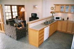
Bungaree Station - Clare  
From: A$220 More Info... |
|
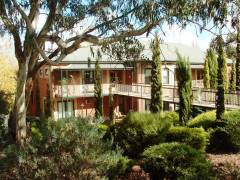
Clare Country Club - Clare 
From: A$296 More Info... |
|
Redwing Barn and Redwing Shearer's Quarters - Weetulta 
From: A$259 More Info... |
Hamley Bridge Map
 Multiple Hotels
  Hotel
Hotel 

