Clifton Accommodation, Hotels, Tours & Information
Places nearby Clifton
- Albion Park Rail
- Alpine
- Appin
- Austinmer
- Avoca
- Avondale
- Aylmerton
- Balarang
- Balgownie
- Bannaby
- Barrack Heights
- Barrack Point
- Barrallier
- Bellambi
- Berkeley
- Blackbutt
- Bombo
- Brownsville
- Bulli
- Bullio
- Calderwood
- Calwalla
- Canyonleigh
- Coalcliff
- Coledale
- Coniston
- Cordeaux Heights
- Corrimal
- Corrimal East
- Cringila
- Dapto
- Darkes Forest
- Douglas Park
- Dunmore
- Fairy Meadow
- Farmborough Heights
- Fernhill
- Figtree
- Flinders
- Foxground
- Garie
- Gerringong
- Gerroa
- Glenquarry
- Gwynneville
- Hanworth
- Helensburgh
- Illawarra
- Jamberoo
- Jerrara
- Kanahooka
- Keiraville
- Kembla Grange
- Kembla Heights
- Kemblawarra
- Kiama
- Kiama Downs
- Kiama Heights
- Knights Hill
- Koonawarra
- Lake Heights
- Lake Illawarra
- Mangerton
- Medway
- Meryla
- Minnamurra
- Mount Keira
- Mount Kembla
- Mount Ousley
- Mount Saint Thomas
- Mount Terry
- Mount Warrigal
- Oak Flats
- Otford
- Paddys River
- Pheasant Ground
- Port Kembla
- Primbee
- Reidtown
- Russell Vale
- Scarborough
- Shellharbour
- Stanwell Park
- Stanwell Tops
- Tarrawanna
- Thirroul
- Towradgi
- Unanderra
- Warilla
- Warrawong
- Warrawong North
- Waterfall
- Wattamolla
- Werri Beach
- West Wollongong
- Wildes Meadow
- Willow Vale
- Wilton
- Windang
- Wingello
- Wollongong
- Wollongong East
- Wollongong North
- Wollongong West
- Wombarra
- Wongawilli
- Woonona
- Yallah
- Yellow Rock
Clifton
Clifton is a rural and residential area mainly along the coast. Clifton is bounded by locality of Coalcliff in the north, Tasman Sea in the east, the locality of Austinmer, the railway line, Wards Creek and Lady Fuller Park in the south and the Illawarra Coast Range in the west. Growth took place in the 1880's, spurred by the establishment of coal mining, with villages established around the coal mines. Major Features include Moronga Park, Rube Hargrave Park and Clifton School of Arts.
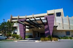
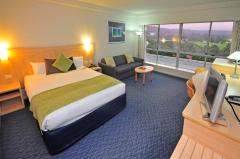
Great deals on hotels in Illawarra...
|
Best Western City Sands - Wollongong 
From: A$321 More Info... |
|
Novotel Wollongong Northbeach - Wollongong
From: A$355 More Info... |

|
The Sebel Kiama - Kiama 
From: A$356 More Info... |
Clifton Map
 Multiple Hotels
  Hotel
Hotel 

