Murchison Accommodation, Hotels, Tours & Information
Places nearby Murchison
- Ajana
- Arrino
- Badgingarra
- Beachlands
- Beacon
- Beresford
- Big Bell
- Binnu
- Binnu West
- Bluff Point
- Boogardie
- Boolardy
- Bootenal
- Bowgada
- Bunjil
- Canna
- Cape Burney
- Carnamah
- Caron
- Coolimba
- Coorow
- Cue
- Dongara
- Drummond Cove
- Eneabba
- Eneabba North
- Eradu
- Gascoyne Junction
- Georgina
- Geraldton
- Glenburgh
- Glenfield
- Green Head
- Greenough
- Gutha
- Horrocks
- Howatharra
- Hutt
- Indarra
- Irwin
- Isseka
- Jameson
- Jurien Bay
- Kalbarri
- Karloo
- Kojarena
- Koolanooka
- Latham
- Lawlers
- Leeman
- Leinster
- Lynton
- Mahomets Flats
- Marchagee
- Meekatharra
- Merkanooka
- Mingenew
- Moonyoonooka
- Morawa
- Moresby
- Mount Erin
- Mount Magnet
- Mount Narryer
- Mount Tarcoola
- Mullewa
- Murgoo
- Nabawa
- Nannine
- Nanson
- Naraling
- Narngulu
- Northampton
- Northern Gully
- Oakajee
- Oakbella
- Ogilvie
- Paynes Find
- Paynesville
- Perenjori
- Pindar
- Pintharuka
- Point Moore
- Port Denison
- Port Gregory
- Rangeway
- Reedy
- Regional West Australia
- Sandstone
- Snag Island
- Spalding
- Strathalbyn
- Sunset Beach
- Tarcoola Beach
- Tardun
- Tenindewa
- Three Springs
- Tuckanarra
- Utakarra
- Waddy Forest
- Waggrakine
- Walkaway
- Wandina
- Webberton
- West End
- Whelarra
- Wicherina
- Wilroy
- Wiluna
- Winchester
- Wongoondy
- Wonthella
- Wooree
- Woorree
- Wurarga
- Yalgoo
- Yandanooka
- Yeelirrie
- Youanmi
- Yuin
- Yuna
Murchison
Murchison, three and a half hours drive northeast of Geraldton, depicts the real Australian outback with open space, beautiful scenery, natural pools, historic homesteads and an abundance of wildlife. Situated on the Murchison River, Murchison's surrounds are mainly pastoral lands which offer the chance to experience working with sheep and cattle on the unique station stays available. The Shire of Murchison consists of 26 pastoral leases, an Aboriginal and a Local Government reserve, areas of vacant crown land and various other reserves. The Shire of Murchison is also known as the Shire without a town, there being no gazetted townsite within the Shire and only the Murchison Settlement being the major source of population and services. Murchison Settlement is where everything happens. It is the location of the Shire Office, the Murchison Sports Club, the Murchison Museum and the Murchison Oasis Roadhouse and Caravan Park. Just a 20 minute drive to the settlement's west are the rock formations of Errabiddy Bluff which can be seen from distances of over 30 kilometres. Have a picnic or partake of the great challenge of scaling the bluff. Abundant wildlife is in this area. Approximately 150 kilometres north of the Murchison Settlement is Bilung Pool. This natural water feature has year round water and picnic facilities are available. Located 80 kilometres south of the Murchison Settlement is Ballinyoo Bridge; built in the 1930s this was the second ever concrete bridge constructed in Western Australia. Permanent pools are at the crossing of the Murchison River. In spring, after winter's rainfall, wildflowers including everlastings and acacias bloom. As well as station stay accommodation, the Murchison area offers a roadhouse, caravan park and camping options.
Great deals on hotels in Mid West...
|
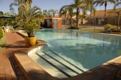
Hospitality Geraldton, SureStay Collection by Best Western - Geraldton  
From: A$169 More Info... |

|
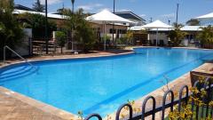
Kalbarri Edge Resort - Kalbarri  
From: A$199 More Info... |
|
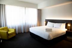
Nesuto Geraldton Apartment Hotel - Geraldton 
From: A$270 More Info... |
|
The Gerald Apartment Hotel - Geraldton
From: A$282 More Info... |

Murchison
Murchison Map
 Multiple Hotels
  Hotel
Hotel 

