Perenjori Accommodation, Hotels, Tours & Information
Places nearby Perenjori
- Ajana
- Arrino
- Badgingarra
- Beachlands
- Beacon
- Beresford
- Big Bell
- Binnu
- Binnu West
- Bluff Point
- Boogardie
- Boolardy
- Bootenal
- Bowgada
- Bunjil
- Canna
- Cape Burney
- Carnamah
- Caron
- Coolimba
- Coorow
- Cue
- Dongara
- Drummond Cove
- Eneabba
- Eneabba North
- Eradu
- Gascoyne Junction
- Georgina
- Geraldton
- Glenburgh
- Glenfield
- Green Head
- Greenough
- Gutha
- Horrocks
- Howatharra
- Hutt
- Indarra
- Irwin
- Isseka
- Jameson
- Jurien Bay
- Kalbarri
- Karloo
- Kojarena
- Koolanooka
- Latham
- Lawlers
- Leeman
- Leinster
- Lynton
- Mahomets Flats
- Marchagee
- Meekatharra
- Merkanooka
- Mingenew
- Moonyoonooka
- Morawa
- Moresby
- Mount Erin
- Mount Magnet
- Mount Narryer
- Mount Tarcoola
- Mullewa
- Murchison
- Murgoo
- Nabawa
- Nannine
- Nanson
- Naraling
- Narngulu
- Northampton
- Northern Gully
- Oakajee
- Oakbella
- Ogilvie
- Paynes Find
- Paynesville
- Pindar
- Pintharuka
- Point Moore
- Port Denison
- Port Gregory
- Rangeway
- Reedy
- Regional West Australia
- Sandstone
- Snag Island
- Spalding
- Strathalbyn
- Sunset Beach
- Tarcoola Beach
- Tardun
- Tenindewa
- Three Springs
- Tuckanarra
- Utakarra
- Waddy Forest
- Waggrakine
- Walkaway
- Wandina
- Webberton
- West End
- Whelarra
- Wicherina
- Wilroy
- Wiluna
- Winchester
- Wongoondy
- Wonthella
- Wooree
- Woorree
- Wurarga
- Yalgoo
- Yandanooka
- Yeelirrie
- Youanmi
- Yuin
- Yuna
Perenjori
Perenjori comes from the Aboriginal word 'perangery', meaning waterhole and is situated on the Wubin-Mullewa Highway, three and a half hours drive from Perth. In 1915 the railway line was officially opened and the population was 100. Today Perenjori is one of the largest agricultural shires in Western Australia including farming, pastoral and mining leases. Displays of wildflowers bloom from August to October. The famous and unique Wreath Leschenaultia appears in September to October and can be seen in Perenjori and surrounding areas. The whole landscape comes alive with colour and the activities of bird life. A great variety of birdlife including black cockatoos, galahs and corellas can be found. Recently the Monsignor John Hawes Heritage Trail was rediscovered. Monsignor Hawes was the architect and, in a lot of cases, the builder of more than 15 beautiful and unusual churches in the mid west of the State. The town has the unusual Catholic Church of St Joseph, which is a tribute to the work of Monsignor Hawes. Join the growing numbers of visitors exploring the exciting and totally absorbing history of Monsignor John Hawes, starting at Perenjori and moving north to Morawa, Mullewa, Geraldton, Northampton, Yalgoo, Nanson and Bluff Point. From Lake Monger lookout you can view a portion of Lake Monger, a salt lake that runs north and south for some 185 kilometres and is 7.5 kilometres wide in places. There is also a small gorge, many of the caves along the slopes are used by kangaroos as resting areas Other interest points near Perenjori include Koolanooka Springs Mine and Picnic area north west of Perenjori, Beryl Mine 67 kilometres north east of Perenjori. Perenjori offers home stays, a hotel/motel and a caravan park.
Great deals on hotels in Mid West...
|
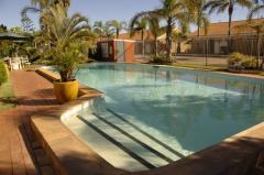
Hospitality Geraldton, SureStay Collection by Best Western - Geraldton  
From: A$169 More Info... |

|
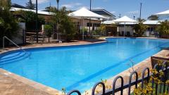
Kalbarri Edge Resort - Kalbarri  
From: A$199 More Info... |
|
Nesuto Geraldton Apartment Hotel - Geraldton 
From: A$270 More Info... |

|
The Gerald Apartment Hotel - Geraldton
From: A$282 More Info... |

Perenjori
Perenjori Map
 Multiple Hotels
  Hotel
Hotel 

