Yarraman Accommodation, Hotels, Tours & Information
Places nearby Yarraman
- Acland
- Amby
- Amiens
- Anduramba
- Aubigny
- Ballandean
- Ballard
- Bell
- Benarkin
- Blackbutt
- Blaxland
- Bongeen
- Boonarga
- Bowenville
- Brigalow
- Brooklands
- Brookstead
- Bungunya
- Burncluith
- Byee
- Cabarlah
- Cambooya
- Carnarvon Gorge
- Carnarvon National Park
- Cawdor
- Cecil Plains
- Cement Mills
- Centenary Heights
- Clifton
- Cloyna
- Coalbank
- Columboola
- Condamine
- Coolabunia
- Cooranga North
- Cooyar
- Cranley
- Crownthorpe
- Crows Nest
- Cunningham
- Cushnie
- Daandine
- Darling Heights
- Derrymore
- Dirranbandi
- Djuan
- Drayton
- Drayton North
- Drillham
- Dulacca
- Durong South
- East Toowoomba
- Ellesmere
- Emu Creek
- Felton East
- Flagstone Creek
- Glen Aplin
- Glenmorgan
- Glenvale
- Goodger
- Goombungee
- Gordonbrook
- Gore
- Gowrie
- Gowrie Junction
- Greenmount
- Greenview
- Guluguba
- Haden
- Hampton
- Harlaxton
- Harristown
- Hebel
- Helidon
- Hirstglen
- Hivesville
- Hodgson Vale
- Injune
- Irvingdale
- Jackson
- Jandowae
- Jimbour
- Jondaryan
- Jones Gully
- Kaimkillenbun
- Karara
- Kearneys Spring
- Kingsthorpe
- Kinleymore
- Kleinton
- Kogan
- Kulpi
- Kumbia
- Kupunn
- Leyburn
- Lilydale
- Limevale
- Lockyer
- Macalister
- Maclagan
- Maidenwell
- Meandarra
- Memerambi
- Meringandan
- Middle Ridge
- Miles
- Mondure
- Moonie
- Mount Kynoch
- Mount Lofty
- Mount Tyson
- Muckadilla
- Mungallala
- Murphys Creek
- Nobby
- Oman-ama
- Peranga
- Picnic Point
- Pilton
- Pinelands
- Pirrinuan
- Pittsworth
- Plainby
- Postmans Ridge
- Pratten
- Preston
- Prince Henry Heights
- Proston
- Quinalow
- Rangeville
- Redwood
- Rockville
- Southbrook
- Speedwell
- Spring Bluff
- Stalworth
- Stockyard
- Surat
- Sylvia Vale
- Talwood
- Tarong
- Taroom
- Thallon
- The Gums
- Tingoora
- Toowoomba
- Toowoomba East
- Toowoomba South
- Toowoomba West
- Upper Lockyer
- Wallumbilla
- Wandoan
- Warra
- Wellcamp
- Westbrook
- Wilsonton
- Windera
- Withcott
- Wooroolin
- Wyreema
- Yamsion
- Yelarbon
- Yuleba
Yarraman
Out Kingaroy way, about 200 kilometres north-west of Brisbane, Yarraman sits at the junction of the New England and D'Aguilar highways.
While this was a gold mining district until the early 1900s, the area now produces beef cattle and crops - mainly grain and beans.
The Berlin's Gem and Historical Museum is worth a visit, and the Yarran and Benarkin State Forests are close by and so, too, are the spectacular Bunya Mountains.
A scenic drive skirting the forest takes visitors to Tarong Power Station but you have to book in advance to take one of the free tours which operate between 9am and 2pm Tuesday to Friday.
Yarraman is central to a rich and diverse area which combines a healthy mix of agriculture, conserved parkland, industry and man-made aquatic playgrounds such as Boondooma and Bjelke-Petersen dams.
The largest town in the area, Kingaroy, is at the heart of peanut and naval (baked) bean production, and a very special brand of conservative politics as practised and perfected by long-time Queensland Premier, Sir Joh and Lady Flo Bjelke-Petersen.
Great deals on hotels in Toowoomba...
|
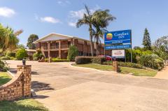
Comfort Inn Glenfield - Toowoomba  
From: A$173 More Info... |
Yarraman Map
 Multiple Hotels
  Hotel
Hotel 

