Barrington Tops Accommodation, Hotels, Tours & Information
Places nearby Barrington Tops
- Aberdeen
- Aberglasslyn
- Abermain
- Abernethy
- Alison
- Allandale
- Allynbrook
- Antiene
- Apple Tree Flat
- Arcadia Vale
- Ardglen
- Ashtonfield
- Baerami
- Baerami Creek
- Bandon Grove
- Belford
- Bellbird
- Bendolba
- Berry Park
- Bishops Bridge
- Black Hill
- Blandford
- Bolwarra
- Bolwarra Heights
- Borambil
- Boree
- Bow
- Bowmans Creek
- Branxton
- Broke
- Brookfield
- Brunkerville
- Buchanan
- Bucketty
- Bulga
- Bunnan
- Bureen
- Buttai
- Bylong
- Camberwell
- Carrowbrook
- Cassilis
- Castle Rock
- Cessnock
- Cessnock West
- Chichester
- Clarence Town
- Congewai
- Cooranbong
- Coulsons Creek
- Craven
- Dalwood
- Dangarfield
- Dartbrook
- Davis Creek
- Dawsons Hill
- Dellhurst
- Denman
- Doyles Creek
- Duckenfield
- Dungog
- Dunolly
- Dusodie
- East Gresford
- East Greta
- East Maitland
- Eccleston
- Elderslie
- Ellalong
- Ellerston
- Falbrook
- Farley
- Fordwich
- Freemans Waterhole
- Glen Gallic
- Glen Oak
- Glen William
- Glendon Brook
- Glennies Creek
- Goorangoola
- Gosforth
- Gouldsville
- Greenland
- Gresford
- Greta
- Greta Main
- Gundy
- Gungal
- Halton
- Hebden
- Heddon Greta
- Highfields
- Hilldale
- Hinton
- Hollydeen
- Horseshoe Bend
- Howes Valley
- Hunter Valley
- Ingar
- Iona
- Jerrys Plains
- Kankool
- Kars Springs
- Kayuga
- Kearsley
- Keinbah
- Kerrabee
- Kitchener
- Kurri Kurri
- Laguna
- Lambs Valley
- Largs
- Lemington
- Lewinsbrook
- Liddell
- Lochinvar
- Lorn
- Lostock
- Louth Park
- Lovedale
- Lower Belford
- Loxford
- Luskintyre
- Main Creek
- Maitland
- Maitland Vale
- Mandalong
- Mangoola
- Manobalai
- Marshdale
- Martindale
- Martins Creek
- Martinsville
- Mccullys Gap
- Melville
- Merriwa
- Metford
- Middle Falbrook
- Milbrodale
- Millers Forest
- Millfield
- Mirannie
- Mirrabooka
- Monkerai
- Moonan Brook
- Moonan Flat
- Mootai
- Morisset
- Morisset East
- Morisset Park
- Morpeth
- Mount Dee
- Mount Olive
- Mount Pleasant
- Mount Rivers
- Mount Thorley
- Mount View
- Mount Vincent
- Mulbring
- Murrurundi
- Muscle Creek
- Muswellbrook
- Myambat
- Myuna Bay
- Neath
- Nelsons Plains
- North Rothbury
- Nr Gresford
- Nulkaba
- Oakhampton
- Oswald
- Owens Gap
- Parkville
- Paterson
- Paxton
- Paynes Crossing
- Pelaw Main
- Pelton
- Phoenix Park
- Pokolbin
- Putty
- Quorrobolong
- Ravensworth
- Raworth
- Rosebrook
- Rothbury
- Rouchel Brook
- Rutherford
- Ryhope
- Salisbury
- Sandy Hollow
- Satur
- Sawyers Gully
- Scone
- Scotts Flat
- Seaham
- Seaham East
- Seahampton
- Sedgefield
- Segenhoe
- Singleton
- Singleton Heights
- St Albans
- Stanford Merthyr
- Stanhope
- Stockrington
- Summerland Point
- Sunshine
- Sweetmans Creek
- Telarah
- Tenambit
- Timor
- Torryburn
- Underbank
- Upper Rouchel
- Vacy
- Wallalong
- Wallarobba
- Wards River
- Warkworth
- Warrah Creek
- Watagan
- Weismantels
- Westbrook
- Weston
- Whittingham
- Widden
- Willow Tree
- Windermere Park
- Wingen
- Wirragulla
- Wollar
- Wollombi
- Woodville
- Woolooma
- Wybong
- Wyee Point
- Yallambie
- Yango
- Yarrawonga Park
Barrington Tops
High basalt cliffs and rainforest wilderness, sphagnum moss swamps and trout streams and rolling farmland characterise this World Heritage Listed area, north-west of Maitland, NSW.
This 25 km long plateau stretches between a set of now-extinct volcanic peaks giving rise to a variety of ecosystems and habitats. In winter snowgums in the subalpine forests can be lightly covered with crisp white snow, melting to become free flowing streams of clear water that cascade down the slopes to the coast. Fed by mist and an annual rainfall that can exceed 1500 millilitres, the water passes through beech forests, remnant rainforest or is filtered through sphagnum moss swamp or wet eucalypt forest to make up the wild waters of the Chichester, Wangat, Paterson and Williams rivers.
Barrington Tops is home to diverse plant and animal life, including rare and endangered species. Delicate spring wildflowers, ancient rainforest, fern-lined gorges and heathland are home the tiger quoll, the powerful of the sooty owls, re-legged pademelon and the sphagnum frog. Watch out for the brightly coloured rifle bird and flocks of black cockatoos.
Take time to enjoy the breath-taking views from the highest peaks at Mount Barrington where on a clear day you may see over the forest below and the farmland beyond all the way to the white sands of the coast.
The area is divided into both State Forest and National Park offering different ways to enjoy Barrington Tops. Access roads can be rough - but points of attraction are generally accessible in conventional vehicle. The major towns in the nearby area are: Gloucester , Dungog , and Muswellbrook and Scone.
Things to Do:
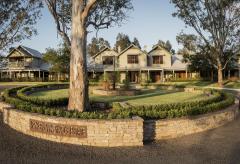
Great deals on hotels in Hunter Valley...

|
Best Western Endeavour Motel - East Maitland 
From: A$185 More Info... |

|
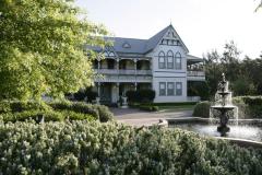
Chateau Elan Hunter Valley - Rothbury  
From: A$326 More Info... |

|
Estate Tuscany - Pokolbin 
From: A$291 More Info... |

|
Hunter Valley Resort + Farm - Pokolbin 
From: A$250 More Info... |
|
Spicers Guesthouse - Pokolbin 
From: A$537 More Info... |
|
Spicers Vineyards Estate - Pokolbin 
From: A$652 More Info... |
|
The Convent Hunter Valley - Pokolbin
From: A$451 More Info... |
Barrington Tops Map
 Multiple Hotels
  Hotel
Hotel 

