Putty Accommodation, Hotels, Tours & Information
Places nearby Putty
- Aberdeen
- Aberglasslyn
- Abermain
- Abernethy
- Alison
- Allandale
- Allynbrook
- Antiene
- Apple Tree Flat
- Arcadia Vale
- Ardglen
- Ashtonfield
- Baerami
- Baerami Creek
- Bandon Grove
- Barrington Tops
- Belford
- Bellbird
- Bendolba
- Berry Park
- Bishops Bridge
- Black Hill
- Blandford
- Bolwarra
- Bolwarra Heights
- Borambil
- Boree
- Bow
- Bowmans Creek
- Branxton
- Broke
- Brookfield
- Brunkerville
- Buchanan
- Bucketty
- Bulga
- Bunnan
- Bureen
- Buttai
- Bylong
- Camberwell
- Carrowbrook
- Cassilis
- Castle Rock
- Cessnock
- Cessnock West
- Chichester
- Clarence Town
- Congewai
- Cooranbong
- Coulsons Creek
- Craven
- Dalwood
- Dangarfield
- Dartbrook
- Davis Creek
- Dawsons Hill
- Dellhurst
- Denman
- Doyles Creek
- Duckenfield
- Dungog
- Dunolly
- Dusodie
- East Gresford
- East Greta
- East Maitland
- Eccleston
- Elderslie
- Ellalong
- Ellerston
- Falbrook
- Farley
- Fordwich
- Freemans Waterhole
- Glen Gallic
- Glen Oak
- Glen William
- Glendon Brook
- Glennies Creek
- Goorangoola
- Gosforth
- Gouldsville
- Greenland
- Gresford
- Greta
- Greta Main
- Gundy
- Gungal
- Halton
- Hebden
- Heddon Greta
- Highfields
- Hilldale
- Hinton
- Hollydeen
- Horseshoe Bend
- Howes Valley
- Hunter Valley
- Ingar
- Iona
- Jerrys Plains
- Kankool
- Kars Springs
- Kayuga
- Kearsley
- Keinbah
- Kerrabee
- Kitchener
- Kurri Kurri
- Laguna
- Lambs Valley
- Largs
- Lemington
- Lewinsbrook
- Liddell
- Lochinvar
- Lorn
- Lostock
- Louth Park
- Lovedale
- Lower Belford
- Loxford
- Luskintyre
- Main Creek
- Maitland
- Maitland Vale
- Mandalong
- Mangoola
- Manobalai
- Marshdale
- Martindale
- Martins Creek
- Martinsville
- Mccullys Gap
- Melville
- Merriwa
- Metford
- Middle Falbrook
- Milbrodale
- Millers Forest
- Millfield
- Mirannie
- Mirrabooka
- Monkerai
- Moonan Brook
- Moonan Flat
- Mootai
- Morisset
- Morisset East
- Morisset Park
- Morpeth
- Mount Dee
- Mount Olive
- Mount Pleasant
- Mount Rivers
- Mount Thorley
- Mount View
- Mount Vincent
- Mulbring
- Murrurundi
- Muscle Creek
- Muswellbrook
- Myambat
- Myuna Bay
- Neath
- Nelsons Plains
- North Rothbury
- Nr Gresford
- Nulkaba
- Oakhampton
- Oswald
- Owens Gap
- Parkville
- Paterson
- Paxton
- Paynes Crossing
- Pelaw Main
- Pelton
- Phoenix Park
- Pokolbin
- Quorrobolong
- Ravensworth
- Raworth
- Rosebrook
- Rothbury
- Rouchel Brook
- Rutherford
- Ryhope
- Salisbury
- Sandy Hollow
- Satur
- Sawyers Gully
- Scone
- Scotts Flat
- Seaham
- Seaham East
- Seahampton
- Sedgefield
- Segenhoe
- Singleton
- Singleton Heights
- St Albans
- Stanford Merthyr
- Stanhope
- Stockrington
- Summerland Point
- Sunshine
- Sweetmans Creek
- Telarah
- Tenambit
- Timor
- Torryburn
- Underbank
- Upper Rouchel
- Vacy
- Wallalong
- Wallarobba
- Wards River
- Warkworth
- Warrah Creek
- Watagan
- Weismantels
- Westbrook
- Weston
- Whittingham
- Widden
- Willow Tree
- Windermere Park
- Wingen
- Wirragulla
- Wollar
- Wollombi
- Woodville
- Woolooma
- Wybong
- Wyee Point
- Yallambie
- Yango
- Yarrawonga Park
Putty
Putty is a village in New South Wales, Australia in Singleton Shire. It is north-west of Sydney on the Putty Road between Windsor and Singleton
The village lies in a wide valley. The knee-deep Putty Creek, or the Tupa, rises in north at the foot of Mt Kindarun, and runs the length of the valley before joining with the Wollemi Creek which then feeds into the Colo River.
Adjoining the Putty Road (State Route 69) at a distance of 81 kilometres from Singleton and 91 kilometres from Windsor, Putty Valley Road services the northern stretch of the valley, while the recently relocated Box Gap Road services the south western end.
Land holdings in the area extend to the boundaries of the Wollemi National Park in the west and south, the Putty State Forest in the north and the Yengo National Park in the East.
Great deals on hotels in Hunter Valley...

|
Best Western Endeavour Motel - East Maitland 
From: A$185 More Info... |

|
Chateau Elan Hunter Valley - Rothbury  
From: A$326 More Info... |

|
Estate Tuscany - Pokolbin 
From: A$291 More Info... |

|
Hunter Valley Resort + Farm - Pokolbin 
From: A$250 More Info... |
|
Spicers Guesthouse - Pokolbin 
From: A$537 More Info... |
|
Spicers Vineyards Estate - Pokolbin 
From: A$652 More Info... |
|
The Convent Hunter Valley - Pokolbin
From: A$451 More Info... |
Putty Map
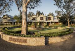
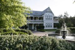
 Multiple Hotels
  Hotel
Hotel 

