St Albans Accommodation, Hotels, Tours & Information
Places nearby St Albans
- Aberdeen
- Aberglasslyn
- Abermain
- Abernethy
- Alison
- Allandale
- Allynbrook
- Antiene
- Apple Tree Flat
- Arcadia Vale
- Ardglen
- Ashtonfield
- Baerami
- Baerami Creek
- Bandon Grove
- Barrington Tops
- Belford
- Bellbird
- Bendolba
- Berry Park
- Bishops Bridge
- Black Hill
- Blandford
- Bolwarra
- Bolwarra Heights
- Borambil
- Boree
- Bow
- Bowmans Creek
- Branxton
- Broke
- Brookfield
- Brunkerville
- Buchanan
- Bucketty
- Bulga
- Bunnan
- Bureen
- Buttai
- Bylong
- Camberwell
- Carrowbrook
- Cassilis
- Castle Rock
- Cessnock
- Cessnock West
- Chichester
- Clarence Town
- Congewai
- Cooranbong
- Coulsons Creek
- Craven
- Dalwood
- Dangarfield
- Dartbrook
- Davis Creek
- Dawsons Hill
- Dellhurst
- Denman
- Doyles Creek
- Duckenfield
- Dungog
- Dunolly
- Dusodie
- East Gresford
- East Greta
- East Maitland
- Eccleston
- Elderslie
- Ellalong
- Ellerston
- Falbrook
- Farley
- Fordwich
- Freemans Waterhole
- Glen Gallic
- Glen Oak
- Glen William
- Glendon Brook
- Glennies Creek
- Goorangoola
- Gosforth
- Gouldsville
- Greenland
- Gresford
- Greta
- Greta Main
- Gundy
- Gungal
- Halton
- Hebden
- Heddon Greta
- Highfields
- Hilldale
- Hinton
- Hollydeen
- Horseshoe Bend
- Howes Valley
- Hunter Valley
- Ingar
- Iona
- Jerrys Plains
- Kankool
- Kars Springs
- Kayuga
- Kearsley
- Keinbah
- Kerrabee
- Kitchener
- Kurri Kurri
- Laguna
- Lambs Valley
- Largs
- Lemington
- Lewinsbrook
- Liddell
- Lochinvar
- Lorn
- Lostock
- Louth Park
- Lovedale
- Lower Belford
- Loxford
- Luskintyre
- Main Creek
- Maitland
- Maitland Vale
- Mandalong
- Mangoola
- Manobalai
- Marshdale
- Martindale
- Martins Creek
- Martinsville
- Mccullys Gap
- Melville
- Merriwa
- Metford
- Middle Falbrook
- Milbrodale
- Millers Forest
- Millfield
- Mirannie
- Mirrabooka
- Monkerai
- Moonan Brook
- Moonan Flat
- Mootai
- Morisset
- Morisset East
- Morisset Park
- Morpeth
- Mount Dee
- Mount Olive
- Mount Pleasant
- Mount Rivers
- Mount Thorley
- Mount View
- Mount Vincent
- Mulbring
- Murrurundi
- Muscle Creek
- Muswellbrook
- Myambat
- Myuna Bay
- Neath
- Nelsons Plains
- North Rothbury
- Nr Gresford
- Nulkaba
- Oakhampton
- Oswald
- Owens Gap
- Parkville
- Paterson
- Paxton
- Paynes Crossing
- Pelaw Main
- Pelton
- Phoenix Park
- Pokolbin
- Putty
- Quorrobolong
- Ravensworth
- Raworth
- Rosebrook
- Rothbury
- Rouchel Brook
- Rutherford
- Ryhope
- Salisbury
- Sandy Hollow
- Satur
- Sawyers Gully
- Scone
- Scotts Flat
- Seaham
- Seaham East
- Seahampton
- Sedgefield
- Segenhoe
- Singleton
- Singleton Heights
- Stanford Merthyr
- Stanhope
- Stockrington
- Summerland Point
- Sunshine
- Sweetmans Creek
- Telarah
- Tenambit
- Timor
- Torryburn
- Underbank
- Upper Rouchel
- Vacy
- Wallalong
- Wallarobba
- Wards River
- Warkworth
- Warrah Creek
- Watagan
- Weismantels
- Westbrook
- Weston
- Whittingham
- Widden
- Willow Tree
- Windermere Park
- Wingen
- Wirragulla
- Wollar
- Wollombi
- Woodville
- Woolooma
- Wybong
- Wyee Point
- Yallambie
- Yango
- Yarrawonga Park
St Albans
St Albans is located approximately 90 kilometres northwest of the Sydney central business district in the City of Hawkesbury. The original inhabitants of the St Albans area were the Darug people. The Darug were the custodians of the majority of what is now the Greater Sydney region. St Albans was originally known as Macdonald, but was officially gazetted in 1814 as St Albans. The village is believed to have been named after the English hometown of William Bailey who lived at ムFirst Farm'. It was officially declared a town in 1885. St Albans was mainly used by early settlers for running cattle on the fertile flood plains of the Macdonald River. Remnants of this early activity still remain today.Today, St Albans is a sought after retreat for weekenders. The ambience of the historic pub evokes images of days gone by. A local gallery and restaurant is also worth exploring.
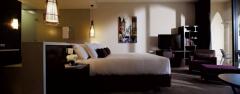
Great deals on hotels in Hunter Valley...
|
Chateau Elan Hunter Valley - Rothbury  
From: A$318 More Info... |

|
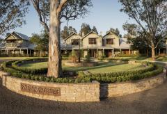
Hunter Valley Resort + Farm - Pokolbin  
From: A$249 More Info... |
|
Spicers Guesthouse - Pokolbin 
From: A$522 More Info... |
|
Spicers Vineyards Estate - Pokolbin 
From: A$630 More Info... |

St Albans
St Albans Map
 Multiple Hotels
  Hotel
Hotel 

