Warkworth Accommodation, Hotels, Tours & Information
Places nearby Warkworth
- Aberdeen
- Aberglasslyn
- Abermain
- Abernethy
- Alison
- Allandale
- Allynbrook
- Antiene
- Apple Tree Flat
- Arcadia Vale
- Ardglen
- Ashtonfield
- Baerami
- Baerami Creek
- Bandon Grove
- Barrington Tops
- Belford
- Bellbird
- Bendolba
- Berry Park
- Bishops Bridge
- Black Hill
- Blandford
- Bolwarra
- Bolwarra Heights
- Borambil
- Boree
- Bow
- Bowmans Creek
- Branxton
- Broke
- Brookfield
- Brunkerville
- Buchanan
- Bucketty
- Bulga
- Bunnan
- Bureen
- Buttai
- Bylong
- Camberwell
- Carrowbrook
- Cassilis
- Castle Rock
- Cessnock
- Cessnock West
- Chichester
- Clarence Town
- Congewai
- Cooranbong
- Coulsons Creek
- Craven
- Dalwood
- Dangarfield
- Dartbrook
- Davis Creek
- Dawsons Hill
- Dellhurst
- Denman
- Doyles Creek
- Duckenfield
- Dungog
- Dunolly
- Dusodie
- East Gresford
- East Greta
- East Maitland
- Eccleston
- Elderslie
- Ellalong
- Ellerston
- Falbrook
- Farley
- Fordwich
- Freemans Waterhole
- Glen Gallic
- Glen Oak
- Glen William
- Glendon Brook
- Glennies Creek
- Goorangoola
- Gosforth
- Gouldsville
- Greenland
- Gresford
- Greta
- Greta Main
- Gundy
- Gungal
- Halton
- Hebden
- Heddon Greta
- Highfields
- Hilldale
- Hinton
- Hollydeen
- Horseshoe Bend
- Howes Valley
- Hunter Valley
- Ingar
- Iona
- Jerrys Plains
- Kankool
- Kars Springs
- Kayuga
- Kearsley
- Keinbah
- Kerrabee
- Kitchener
- Kurri Kurri
- Laguna
- Lambs Valley
- Largs
- Lemington
- Lewinsbrook
- Liddell
- Lochinvar
- Lorn
- Lostock
- Louth Park
- Lovedale
- Lower Belford
- Loxford
- Luskintyre
- Main Creek
- Maitland
- Maitland Vale
- Mandalong
- Mangoola
- Manobalai
- Marshdale
- Martindale
- Martins Creek
- Martinsville
- Mccullys Gap
- Melville
- Merriwa
- Metford
- Middle Falbrook
- Milbrodale
- Millers Forest
- Millfield
- Mirannie
- Mirrabooka
- Monkerai
- Moonan Brook
- Moonan Flat
- Mootai
- Morisset
- Morisset East
- Morisset Park
- Morpeth
- Mount Dee
- Mount Olive
- Mount Pleasant
- Mount Rivers
- Mount Thorley
- Mount View
- Mount Vincent
- Mulbring
- Murrurundi
- Muscle Creek
- Muswellbrook
- Myambat
- Myuna Bay
- Neath
- Nelsons Plains
- North Rothbury
- Nr Gresford
- Nulkaba
- Oakhampton
- Oswald
- Owens Gap
- Parkville
- Paterson
- Paxton
- Paynes Crossing
- Pelaw Main
- Pelton
- Phoenix Park
- Pokolbin
- Putty
- Quorrobolong
- Ravensworth
- Raworth
- Rosebrook
- Rothbury
- Rouchel Brook
- Rutherford
- Ryhope
- Salisbury
- Sandy Hollow
- Satur
- Sawyers Gully
- Scone
- Scotts Flat
- Seaham
- Seaham East
- Seahampton
- Sedgefield
- Segenhoe
- Singleton
- Singleton Heights
- St Albans
- Stanford Merthyr
- Stanhope
- Stockrington
- Summerland Point
- Sunshine
- Sweetmans Creek
- Telarah
- Tenambit
- Timor
- Torryburn
- Underbank
- Upper Rouchel
- Vacy
- Wallalong
- Wallarobba
- Wards River
- Warrah Creek
- Watagan
- Weismantels
- Westbrook
- Weston
- Whittingham
- Widden
- Willow Tree
- Windermere Park
- Wingen
- Wirragulla
- Wollar
- Wollombi
- Woodville
- Woolooma
- Wybong
- Wyee Point
- Yallambie
- Yango
- Yarrawonga Park
Warkworth
Head south out of the town on the Glenridding Road, an extension of John Street. At 6 kilometres is the Maitland turnoff and at 7 kilometres the Broke turn off (along Wollombi Road). Another 2.2 kilometres brings you to an intersection. On the left is the turn off to the Mt Thorley Industrial Area, the base for much of the local mine serving industry. On the right is the road to Denman via Warkworth. If you take the latter a few hundred metres will bring you to a view of the Warkworth Open-Cut Mine. It is 9.5 kilometres to Warkworth itself. Now a coalmining area the land, first granted in 1824, was formerly given over to agricultural and pastoral activities. As you come over and down a hill into Warkworth, on the right-handed side of the road, is Jim Johnstone Park, names after the founder of a nearby colliery. The machine in the grounds is a Lee-norse Continuous Coalmining Machine (1959). Take the immediate right into High Street which runs along the perimeter of the park - north, than west, than south back to the main road. 100 metres down this road, to the right, is a strip of grass leading to St Phillips Anglican Church and cemetery. Work commenced on the building in 1840 though it was not completed until 1853. Edmund Blacket was employed to finish the design in 1851adding side porches, the circular window in the gable, the bell-cote and cross, and possibly the roof. However, it is an extremely modest affair. Continue on from the church. Follow the tarmac as it veers westwards. At the end of this part of the street, before the road turns south back to the main road, is a picnic area by the bridge on Wollombi Creek. John Howe named this part of the creek 'Cockfighter Creek' after a horse of his that became ineluctably mired during the 1817 trek. The bridge was originally a timber truss structure erected in 1817. Warkworth Public School, on High Street, was established in 1859. The Hunter Valley Gliding Club is also located at Warkworth.
Great deals on hotels in Hunter Valley...

|
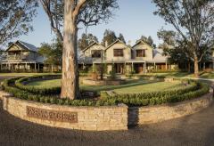
Chateau Elan Hunter Valley - Rothbury  
From: A$318 More Info... |

|
Hunter Valley Resort + Farm - Pokolbin  
From: A$249 More Info... |
|
Spicers Guesthouse - Pokolbin 
From: A$522 More Info... |
|
Spicers Vineyards Estate - Pokolbin 
From: A$630 More Info... |

Warkworth
Warkworth Map
 Multiple Hotels
  Hotel
Hotel 

