Bundoora Accommodation, Hotels, Tours & Information
Places nearby Bundoora
- Alphington
- Anstey
- Arthurs Creek
- Ascot Vale
- Attwood
- Batman
- Bayswater
- Bayswater North
- Bell
- Briar Hill
- Broadmeadows
- Broadmeadows South
- Brunswick
- Brunswick East
- Brunswick North
- Brunswick South
- Brunswick West
- Campbellfield
- Carlton
- Carlton North
- Carlton South
- Clifton Hill
- Clifton Hill East
- Coburg
- Coburg North
- Coolaroo
- Coonans Hill
- Cottles Bridge
- Craigieburn
- Cross Keys
- Croxton
- Croxton West
- Dallas
- Darebin
- Dennis
- Diamond Creek
- Donnybrook
- Doreen
- Eaglemont
- East Preston
- Eltham
- Epping
- Essendon
- Essendon Airport
- Essendon Fields
- Essendon North
- Essendon West
- Fairfield
- Fawkner
- Fawkner East
- Fawkner North
- Fawkner West
- Fitzroy
- Fitzroy North
- Fitzroy South
- Flemington
- Gilberton
- Gladstone Park
- Glenbervie
- Glenroy
- Gowrie
- Greensborough
- Greenvale
- Hadfield
- Heidelberg Heights
- Heidelberg North
- Heidelberg West
- Highpoint West
- Hurstbridge
- Ivanhoe
- Ivanhoe East
- Ivanhoe North
- Jacana
- Jewell
- Kalkallo
- Kangaroo Ground
- Kensington
- Keon Park
- Kingsbury
- Konagaderra
- Lalor
- Lincolnville
- Lower Brunswick
- Lower Plenty
- Macaulay
- Macleod
- Macleod West
- Maidstone
- Maribyrnong
- Meadow Heights
- Melbourne Airport
- Merlynston
- Mernda
- Merri
- Mickleham
- Midhurst
- Mill Park
- Mont Park
- Montmorency
- Moonee Ponds
- Moonee Ponds North
- Moonee Vale
- Morang South
- Moreland
- Moreland East
- Moreland West
- Newlands Estate
- Newmarket
- Niddrie
- Niddrie North
- North Melbourne
- Northcote
- Northcote South
- Northland Centre
- Nutfield
- Oak Park
- Oaklands Junction
- Parkville
- Pascoe Vale
- Pascoe Vale South
- Pender
- Plenty
- Preston
- Preston Lower
- Preston South
- Preston West
- Princes Hill
- Regent
- Regent West
- Research
- Reservoir
- Reservoir East
- Reservoir North
- Reservoir South
- Rosanna
- Roxburgh Park
- Royal Park
- Rushall
- Ruthven
- Smiths Gully
- Somerton
- South Morang
- St Helena
- Strathmore
- Strathmore Heights
- Sumner
- Sydenham
- Sylvester
- Taylors Lakes
- Thomastown
- Thornbury
- Thornbury North
- Travancore
- Tullamarine
- Tullamarine Airport
- Upfield
- Victoria Park
- View Bank
- Watsonia
- Watsons Creek
- Westbreen
- Westgarth
- Westmeadows
- Wollert
- Woodstock
- Yallambie
- Yan Yean
- Yarrambat
- Yuroke
Bundoora
Land around the modern suburb of Bundoora, 15km north-east of the Melbourne CBD, was still being farmed well into the 20th century and development has gone in starts and stops since the State Government opened the Mont Park mental hospital on a huge tract of land during World War I.
Shell-shocked victims of the Great War were treated at Mont Park which also became a base for training the Women's Land Army in World War II.
Since part of Mont Park was taken for the site of La Trobe University in 1965, Bundoora has become an important link in the Victorian education system.
The Phillip Institute of Technology was established in the region in 1972 and the Royal Melbourne Institute of Technology also has a campus in the northern fringes of Bundoora.
Bordered by Darebin Creek and Plenty River, Bundoora is a suburb of 25,000 people in the City of Banyule in Melbourne"s north-east.
The municipality is graced by one of the oldest homesteads in the metropolitan region, Banyule. The home was built from hand-made bricks in the 1840s for Joseph Hawdon who was one of the first settlers to drive cattle overland from NSW into the newly colonial outpost of Victoria. The home, designed in a mix of Romantic Gothic and Tudor Revival styles, was the focal point of a 266ha property in what is now Heidelberg.
After years in the stewardship of the state, Banyule Homestead was sold to a private buyer in 1995 and is no longer open to the public.
Great deals on hotels in Melbourne North...

|
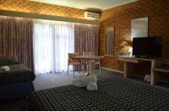
Best Western Airport Motel & Convention Centre - Melbourne Airport 
From: A$199 More Info... |

|
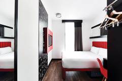
Best Western Plus Travel Inn Hotel - Carlton
From: A$228 More Info... |
|
Essence Hotel Carlton - Carlton 
From: A$190 More Info... |
|
Ibis Styles Melbourne Airport - Melbourne Airport 
From: A$201 More Info... |
|
Novotel Melbourne Airport - Melbourne Airport
From: A$229 More Info... |
|
Quality Hotel Melbourne Airport - Tullamarine
From: A$188 More Info... |
Bundoora Map
 Multiple Hotels
  Hotel
Hotel 

