Hurstbridge Accommodation, Hotels, Tours & Information
Places nearby Hurstbridge
- Alphington
- Anstey
- Arthurs Creek
- Ascot Vale
- Attwood
- Batman
- Bayswater
- Bayswater North
- Bell
- Briar Hill
- Broadmeadows
- Broadmeadows South
- Brunswick
- Brunswick East
- Brunswick North
- Brunswick South
- Brunswick West
- Bundoora
- Campbellfield
- Carlton
- Carlton North
- Carlton South
- Clifton Hill
- Clifton Hill East
- Coburg
- Coburg North
- Coolaroo
- Coonans Hill
- Cottles Bridge
- Craigieburn
- Cross Keys
- Croxton
- Croxton West
- Dallas
- Darebin
- Dennis
- Diamond Creek
- Donnybrook
- Doreen
- Eaglemont
- East Preston
- Eltham
- Epping
- Essendon
- Essendon Airport
- Essendon Fields
- Essendon North
- Essendon West
- Fairfield
- Fawkner
- Fawkner East
- Fawkner North
- Fawkner West
- Fitzroy
- Fitzroy North
- Fitzroy South
- Flemington
- Gilberton
- Gladstone Park
- Glenbervie
- Glenroy
- Gowrie
- Greensborough
- Greenvale
- Hadfield
- Heidelberg Heights
- Heidelberg North
- Heidelberg West
- Highpoint West
- Ivanhoe
- Ivanhoe East
- Ivanhoe North
- Jacana
- Jewell
- Kalkallo
- Kangaroo Ground
- Kensington
- Keon Park
- Kingsbury
- Konagaderra
- Lalor
- Lincolnville
- Lower Brunswick
- Lower Plenty
- Macaulay
- Macleod
- Macleod West
- Maidstone
- Maribyrnong
- Meadow Heights
- Melbourne Airport
- Merlynston
- Mernda
- Merri
- Mickleham
- Midhurst
- Mill Park
- Mont Park
- Montmorency
- Moonee Ponds
- Moonee Ponds North
- Moonee Vale
- Morang South
- Moreland
- Moreland East
- Moreland West
- Newlands Estate
- Newmarket
- Niddrie
- Niddrie North
- North Melbourne
- Northcote
- Northcote South
- Northland Centre
- Nutfield
- Oak Park
- Oaklands Junction
- Parkville
- Pascoe Vale
- Pascoe Vale South
- Pender
- Plenty
- Preston
- Preston Lower
- Preston South
- Preston West
- Princes Hill
- Regent
- Regent West
- Research
- Reservoir
- Reservoir East
- Reservoir North
- Reservoir South
- Rosanna
- Roxburgh Park
- Royal Park
- Rushall
- Ruthven
- Smiths Gully
- Somerton
- South Morang
- St Helena
- Strathmore
- Strathmore Heights
- Sumner
- Sydenham
- Sylvester
- Taylors Lakes
- Thomastown
- Thornbury
- Thornbury North
- Travancore
- Tullamarine
- Tullamarine Airport
- Upfield
- Victoria Park
- View Bank
- Watsonia
- Watsons Creek
- Westbreen
- Westgarth
- Westmeadows
- Wollert
- Woodstock
- Yallambie
- Yan Yean
- Yarrambat
- Yuroke
Hurstbridge
As the big banks continue to alienate their customers by closing branches, perhaps they could indulge in some image patching by taking a lead from a small building now being used as a healing centre on the Hurstbridge Main Road.
The building began its days back in the late 19th century as a wheeled bank which was pulled to different locations by a pair of horses. The old mobile bank is now parked permanently alongside historic Allwood House, a pioneering farm home which doubles as the town community centre.
Part of Nillumbik Shire, Hurstbridge straddles the junction of Diamond and Arthurs creeks on Melbourne's north-eastern fringes. The two creeks become one in Fergusons Paddock, an open space reserve with ponds, paths and picnic facilities.
Hurstbridge is within a half-hour drive of Kinglake National Park, which extends over 21,600ha on the slopes of the Great Dividing Range. Masons Falls interpretive and visitors" centre is the perfect launching pad for a park whose bush trails are studded with scenic lookouts presenting dramatic views of the Melbourne skyline, Port Phillip Bay and over the Yarra Valley to the You Yangs.
Great deals on hotels in Melbourne North...

|
Best Western Airport Motel & Convention Centre - Melbourne Airport 
From: A$202 More Info... |

|
Best Western Plus Travel Inn Hotel - Carlton
From: A$219 More Info... |
|
Essence Hotel Carlton - Carlton  
From: A$190 More Info... |
|
Ibis Styles Melbourne Airport - Melbourne Airport 
From: A$204 More Info... |
|
Novotel Melbourne Airport - Melbourne Airport
From: A$224 More Info... |

|
Parkroyal Melbourne Airport - Melbourne Airport 
From: A$29 More Info... |
|
Quality Hotel Melbourne Airport - Tullamarine
From: A$188 More Info... |
|
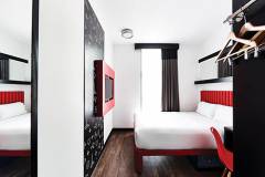
StandardX Melbourne - Fitzroy 
From: A$262 More Info... |

|
The Parkmore Hotel - Parkville
From: A$180 More Info... |
Hurstbridge Map
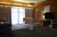
 Multiple Hotels
  Hotel
Hotel 

