Warrawee Accommodation, Hotels, Tours & Information
Places nearby Warrawee
- Akuna Bay
- Allambie
- Allambie Heights
- Annangrove
- Arcadia
- Artarmon
- Asquith
- Avalon
- Avalon Beach
- Balgowlah
- Balgowlah Heights
- Balgowlah North
- Balmain
- Balmain East
- Balmoral
- Balmoral Beach
- Bantry Bay
- Barra Brui
- Baulkham Hills
- Bayview
- Beacon Hill
- Beauty Point
- Beecroft
- Belrose
- Belrose West
- Berkshire Park
- Berowra
- Berowra Heights
- Berowra Waters
- Berrilee
- Bilgola
- Bilgola Beach
- Bilgola Plateau
- Birchgrove
- Blaxlands Ridge
- Bligh Park
- Bobbin Head
- Boronia Park
- Bowen Mountain
- Box Hill
- Brooklyn
- Brookvale
- Cammeray
- Canoelands
- Careel Bay
- Carlingford
- Carlingford North
- Castle Cove
- Castle Hill
- Castlecrag
- Cattai
- Central Colo
- Central Macdonald
- Chatswood
- Chatswood West
- Cheltenham
- Cherrybrook
- Church Point
- Clarendon
- Clareville
- Clareville Beach
- Clifton Gardens
- Clontarf
- Coasters Retreat
- Collaroy
- Collaroy Beach
- Collaroy Plateau
- Collaroy Plateau West
- Colo
- Colo Heights
- Cornwallis
- Cottage Point
- Cowan
- Cremorne
- Cremorne Junction
- Cremorne Point
- Cromer
- Crows Nest
- Curl Curl
- Currawong Beach
- Davidson
- Dee Why
- Dee Why Beach
- Dee Why North
- Denistone
- Denistone East
- Drummoyne
- Duffys Forest
- Dural
- East Killara
- East Lindfield
- East Roseville
- East Ryde
- Eastwood
- Ebenezer
- Elanora Heights
- Elvina Bay
- Epping
- Epping North
- Fairlight
- Fernances
- Fiddletown
- Forestville
- Fox Valley
- Freemans Reach
- Frenchs Forest
- Frenchs Forest East
- Fullers Bridge
- Galston
- Garden Island
- Georges Heights
- Gladesville
- Glenhaven
- Glenorie
- Glenwood
- Glossodia
- Goat Island
- Gordon
- Gore Hill
- Great Mackerel Beach
- Greenwich
- Grose Vale
- Grose Wold
- Gunderman
- Harbord
- Harbord West
- Henley
- Higher Macdonald
- Hillside
- Hobartville
- Hornsby
- Hornsby Heights
- Hunters Hill
- Hunters Hill West
- Huntleys Point
- Ingleside
- Kellyville
- Kenthurst
- Killara
- Killarney Heights
- Kirribilli
- Kurmond
- Kurraba Point
- Kurrajong
- Kurrajong East
- Kurrajong Heights
- Kurrajong Hills
- Lane Cove
- Lane Cove North
- Laughtondale
- Lavender Bay
- Leets Vale
- Lindfield
- Lindfield West
- Linley Point
- Londonderry
- Long Point
- Long Reef
- Longueville
- Loquat Valley
- Lovett Bay
- Lower Hawkesbury
- Lower Macdonald
- Lower Portland
- Lowlands
- Macquarie Park
- Manly
- Manly East
- Manly Vale
- Maraylya
- Maroota
- Maroota South
- Marsden Park
- Marsfield
- McGraths Hill
- McMahons Point
- Meadowbank
- Melrose Park
- Middle Cove
- Middle Dural
- Middle Head
- Milsons Point
- Mona Vale
- Monash Park
- Mosman
- Mount Colah
- Mount Kuring-gai
- Mulgrave
- Naremburn
- Narrabeen
- Narrabeen Peninsula
- Narraweena
- Neutral Bay
- Neutral Bay Junction
- Newport
- Newport Beach
- Normanhurst
- North Avalon
- North Balgowlah
- North Curl Curl
- North Manly
- North Narrabeen
- North Richmond
- North Ryde
- North Seaforth
- North Steyne
- North Sydney
- North Turramurra
- Northbridge
- Northwood
- Oakville
- Oxford Falls
- Palm Beach
- Pennant Hills
- Pitt Town
- Putney
- Pymble
- Queenscliff
- Richmond
- Riverstone
- Riverview
- Rodd Point
- Roselea
- Roseville
- Roseville Chase
- Round Corner
- Rozelle
- Ryde
- Sackville
- Sackville North
- Sackville Reach
- Saint Albans
- Scheyville
- Schofields
- Scotland Island
- Seaforth
- South Turramurra
- Spectacle Island
- Spit Junction
- St Ives
- St Ives Chase
- St Leonards
- Stanhope Gardens
- Taylors Point
- Tennyson
- Terrey Hills
- The Basin
- The Spit
- Thornleigh
- Turramurra
- Turramurra East
- Turramurra North
- Turramurra South
- Upper Colo
- Upper Macdonald
- Vineyard
- Wahroonga
- Wahroonga East
- Wahroonga South
- Waitara
- Waitara East
- Warragamba
- Warriewood
- Waverton
- Webbs Creek
- West Lindfield
- West Pennant Hills
- West Pymble
- West Ryde
- Westleigh
- Whale Beach
- Wheeler Heights
- Wilberforce
- Willoughby
- Willoughby North
- Windsor
- Windsor South
- Wingala
- Wollstonecraft
- Woolwich
- Yarramundi
Warrawee
Divided by the Pacific Highway, Warrawee is a highly desirable address on Sydney's tree-lined and secluded Upper North Shore. The North Shore rail line and the nation's premier road, and its nearby link to the Cumberland Highway, gives Warrawee convenient access to the city, to Parramatta and the west and to the Hawkesbury River and the Central Coast to the north.
Bobbin Head Road on Warrawee's southern boundary also leads directly into Ku-ring-gai Chase National Park and its delightful waterway villages such as Bobbin Head and Apple Tree Bay with their picnic and fishing havens.
Boat ramps access the creek system, the Hawkesbury and Broken Bay. It's a boating paradise, and a special place to teach children the elements of fishing and sailing.
Ku-ring-gai is the name of one of the area"s Aboriginal tribes, the variously spelled Gurringai. In 1894, the tribal name was adapted for the Ku-ring-gai Chase National Park. In 1906 it was also taken by the first local government authority for the area, the Ku-ring-gai Shire Council.
Great deals on hotels in Sydney North...
|
Crowne Plaza Hawkesbury Valley - Windsor 
From: A$363 More Info... |
|
Holiday Inn Express Macquarie Park - Macquarie Park 
From: A$228 More Info... |

|
ibis Sydney Thornleigh - Thornleigh 
From: A$121 More Info... |
|
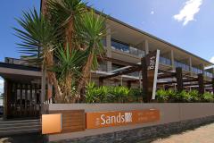
Narrabeen Sands Hotel by Nightcap Plus - Narrabeen  
From: A$330 More Info... |
|
Nesuto Pennant Hills Apartment Hotel - Pennant Hills 
From: A$257 More Info... |
|
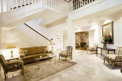
Peppers The Hills Lodge - Castle Hill
From: A$230 More Info... |
|
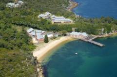
Q Station Sydney Harbour National Park - Manly
From: A$212 More Info... |

|
Spicers Sangoma Retreat - Bowen Mountain  
From: A$2084 More Info... |
|
The Sebel Sydney Chatswood - Chatswood
From: A$299 More Info... |

|
Wildlife Retreat at Taronga - Mosman
From: A$560 More Info... |
Warrawee Map
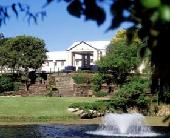
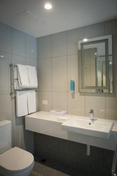
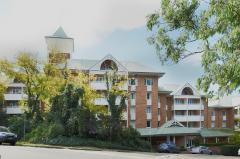
 Multiple Hotels
  Hotel
Hotel 

