Padstow Accommodation, Hotels, Tours & Information
Places nearby Padstow
- Abbotsford
- Annandale
- Arndell Park
- Ashbury
- Ashcroft
- Ashfield
- Auburn
- Auburn North
- Auburn West
- Austral
- Badgerys Creek
- Bass Hill
- Belfield
- Belimbla Park
- Bella Vista
- Berala
- Bickley Vale
- Bidwill
- Birrong
- Blackett
- Blacktown
- Blairmount
- Blaxcell
- Bonnyrigg
- Bossley Park
- Bringelly
- Burwood
- Burwood Heights
- Burwood North
- Busby
- Cabarita
- Cabramatta West
- Cambridge Gardens
- Cambridge Park
- Camellia
- Campsie
- Canada Bay
- Canley Heights
- Canley Vale
- Carramar
- Cartwright
- Castlereagh
- Catherine Field
- Cecil Park
- Chester Hill
- Chipping Norton
- Chiswick
- Chullora
- Claremont Meadows
- Claymore
- Clyde
- Cobbitty
- Colebee
- Colyton
- Concord
- Concord North
- Concord West
- Condell Park
- Cranebrook
- Croydon
- Croydon Park
- Currans Hill
- Dean Park
- Dharruk
- Dobroyd Point
- Doonside
- Dundas
- Dundas Valley
- Dunheved
- East Hills
- Eastern Creek
- Edensor Park
- Edmondson
- Emerton
- Emu Plains
- Enfield
- Enfield South
- Ermington
- Erskine Park
- Erskineville
- Fairfield
- Fairfield Heights
- Fairfield West
- Five Dock
- Flemington
- Forest Lodge
- GINCBR
- Georges Hall
- Girraween
- Glebe Island
- Glebe Point
- Glendenning
- Glenmore Park
- Granville
- Green Valley
- Greenacre
- Greendale
- Greenfield Park
- Greystanes
- Guildford
- Guildford West
- Haberfield
- Harris Park
- Hassall Grove
- Hebersham
- Heckenberg
- Hewitt
- Hinchinbrook
- Homebush
- Homebush Bay
- Homebush West
- Homebush and Homebush Bay
- Horsley Park
- Huntingwood
- Hurlstone Park
- Ingleburn
- Jamisontown
- Kearns
- Kemps Creek
- Kentlyn
- Kings Langley
- Kings Park
- Kingswood
- Kingswood Park
- Lalor Park
- Leichhardt
- Leightonfield
- Lemongrove
- Leonay
- Lethbridge Park
- Lewisham
- Lidcombe
- Lidcombe North
- Lilyfield
- Liverpool South
- Llandilo
- Luddenham
- Lurnea
- Marayong
- Mays Hill
- Merrylands
- Merrylands West
- Miller
- Minchinbury
- Minto
- Mortlake
- Mount Annan
- Mount Druitt
- Mount Hunter
- Mount Lewis
- Mount Pritchard
- Mount Vernon
- Mulgoa
- Nelson
- North Rocks
- North Strathfield
- Northmead
- Oakhurst
- Oatlands
- Old Guildford
- Old Toongabbie
- Orangeville
- Orchard Hills
- Oxley Park
- Padstow Heights
- Panania
- Parklea
- Parramatta East
- Pendle Hill
- Penrith
- Penrith South
- Petersham
- Petersham North
- Plumpton
- Prairiewood
- Prospect
- Punchbowl
- Quakers Hill
- Raby
- Regentville
- Rhodes
- Rookwood
- Rooty Hill
- Rossmore
- Rouse Hill
- Russell Lea
- Rydalmere
- Sadlier
- Sefton
- Seven Hills
- Seven Hills West
- Shalvey
- Shanes Park
- Silverdale
- Silverwater
- Smithfield
- Smithfield West
- South Homebush
- South Strathfield
- Spring Creek
- St Clair
- St Johns Park
- St Marys
- St Marys East
- St Marys North
- St Marys South
- Stanmore
- Strathfield
- Strathfield North
- Strathfield South
- Strathfield West
- Summer Hill
- Sydney University
- Telopea
- Toongabbie
- Toongabbie East
- Tregear
- Villawood
- Wakeley
- Wallacia
- Wareemba
- Wentworthville South
- Werrington
- Werrington County
- Werrington Downs
- West Hoxton
- Westmead
- Wetherill Park
- Whalan
- Willmot
- Winston Hills
- Wisemans Ferry
- Woodcroft
- Woodpark
- Yagoona
- Yagoona West
- Yennora
Padstow
The south-western Sydney suburb of Padstow is on a peninsula flanked by the Little Salt Pan Creek reach of the Georges River, and the bigger reach of Salt Pan Creek.
With all this water around, there's plenty of action to be had for anglers on the trail of bream and flathead. Down by the river is the extensive Georges River State Recreation Area where you can take some lovely walks, enjoy a picnic or a barbecue or wet a line at numerous easily-accessible spots along the banks of the river.
The banks of the Georges River system are well endowed with launching ramps giving recreational boaties direct access to Botany Bay.
The suburb takes its name from the Cornish town of Padstow which was first applied in the Sydney region to 90ha of Georges River land granted to three early settlers, Simon McGuigan, Joseph Cunningham and Michael Conroy.
Today Padstow is part of Bankstown municipality, one of the most densely populated local government areas in the land.
Great deals on hotels in Sydney West...
|
Holiday Inn St Marys - St Marys 
From: A$298 More Info... |
|
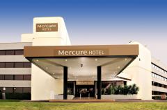
Mercure Penrith - Penrith 
From: A$279 More Info... |
Padstow Map
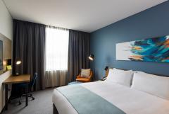
 Multiple Hotels
  Hotel
Hotel 

