Rouse Hill Accommodation, Hotels, Tours & Information
Places nearby Rouse Hill
- Abbotsford
- Annandale
- Arndell Park
- Ashbury
- Ashcroft
- Ashfield
- Auburn
- Auburn North
- Auburn West
- Austral
- Badgerys Creek
- Bass Hill
- Belfield
- Belimbla Park
- Bella Vista
- Berala
- Bickley Vale
- Bidwill
- Birrong
- Blackett
- Blacktown
- Blairmount
- Blaxcell
- Bonnyrigg
- Bossley Park
- Bringelly
- Burwood
- Burwood Heights
- Burwood North
- Busby
- Cabarita
- Cabramatta West
- Cambridge Gardens
- Cambridge Park
- Camellia
- Campsie
- Canada Bay
- Canley Heights
- Canley Vale
- Carramar
- Cartwright
- Castlereagh
- Catherine Field
- Cecil Park
- Chester Hill
- Chipping Norton
- Chiswick
- Chullora
- Claremont Meadows
- Claymore
- Clyde
- Cobbitty
- Colebee
- Colyton
- Concord
- Concord North
- Concord West
- Condell Park
- Cranebrook
- Croydon
- Croydon Park
- Currans Hill
- Dean Park
- Dharruk
- Dobroyd Point
- Doonside
- Dundas
- Dundas Valley
- Dunheved
- East Hills
- Eastern Creek
- Edensor Park
- Edmondson
- Emerton
- Emu Plains
- Enfield
- Enfield South
- Ermington
- Erskine Park
- Erskineville
- Fairfield
- Fairfield Heights
- Fairfield West
- Five Dock
- Flemington
- Forest Lodge
- GINCBR
- Georges Hall
- Girraween
- Glebe Island
- Glebe Point
- Glendenning
- Glenmore Park
- Granville
- Green Valley
- Greenacre
- Greendale
- Greenfield Park
- Greystanes
- Guildford
- Guildford West
- Haberfield
- Harris Park
- Hassall Grove
- Hebersham
- Heckenberg
- Hewitt
- Hinchinbrook
- Homebush
- Homebush Bay
- Homebush West
- Homebush and Homebush Bay
- Horsley Park
- Huntingwood
- Hurlstone Park
- Ingleburn
- Jamisontown
- Kearns
- Kemps Creek
- Kentlyn
- Kings Langley
- Kings Park
- Kingswood
- Kingswood Park
- Lalor Park
- Leichhardt
- Leightonfield
- Lemongrove
- Leonay
- Lethbridge Park
- Lewisham
- Lidcombe
- Lidcombe North
- Lilyfield
- Liverpool South
- Llandilo
- Luddenham
- Lurnea
- Marayong
- Mays Hill
- Merrylands
- Merrylands West
- Miller
- Minchinbury
- Minto
- Mortlake
- Mount Annan
- Mount Druitt
- Mount Hunter
- Mount Lewis
- Mount Pritchard
- Mount Vernon
- Mulgoa
- Nelson
- North Rocks
- North Strathfield
- Northmead
- Oakhurst
- Oatlands
- Old Guildford
- Old Toongabbie
- Orangeville
- Orchard Hills
- Oxley Park
- Padstow
- Padstow Heights
- Panania
- Parklea
- Parramatta East
- Pendle Hill
- Penrith
- Penrith South
- Petersham
- Petersham North
- Plumpton
- Prairiewood
- Prospect
- Punchbowl
- Quakers Hill
- Raby
- Regentville
- Rhodes
- Rookwood
- Rooty Hill
- Rossmore
- Russell Lea
- Rydalmere
- Sadlier
- Sefton
- Seven Hills
- Seven Hills West
- Shalvey
- Shanes Park
- Silverdale
- Silverwater
- Smithfield
- Smithfield West
- South Homebush
- South Strathfield
- Spring Creek
- St Clair
- St Johns Park
- St Marys
- St Marys East
- St Marys North
- St Marys South
- Stanmore
- Strathfield
- Strathfield North
- Strathfield South
- Strathfield West
- Summer Hill
- Sydney University
- Telopea
- Toongabbie
- Toongabbie East
- Tregear
- Villawood
- Wakeley
- Wallacia
- Wareemba
- Wentworthville South
- Werrington
- Werrington County
- Werrington Downs
- West Hoxton
- Westmead
- Wetherill Park
- Whalan
- Willmot
- Winston Hills
- Wisemans Ferry
- Woodcroft
- Woodpark
- Yagoona
- Yagoona West
- Yennora
Rouse Hill
Rouse Hill is located approximately 40 kilometres northwest of the Sydney CBD in the Shire of Baulkham Hills. The original inhabitants of the Oatlands area were the Darug people. The Darug were the custodians of the majority of what is now the Greater Sydney region. They were divided into a number of different ムclans', whose quick demise upon European settlement has sadly resulted in very little information remaining on how the local area was utilised. Rouse Hill is named after the estate of a free settler, Richard Rouse, who arrived in the colony in 1801. He was given a grant of 450 acres in 1816 at Vinegar Hill. Governor Macquarie suggested that the estate be called Rouse Hill. Historians believe this action was taken so the convict association with the area after the Battle of Vinegar Hill would be removed. The battle took place in 1804 between escaped Irish convicts and government-civilian troops. After the fighting, the area became known as Vinegar Hill after a site in County Wexford, Ireland, where Irish and English forces had clashed in 1798. Rouse Hill forms a border between rural and urban landscapes. Although part of a major residential development, Rouse Hill still retains many open farmlands. The area also boasts Rouse Hill Regional Park and historic Rouse Hill Estate, which dates back to 1813. Towns surrounding Rouse Hill include: Annangrove, Box Hill, Glenhaven, Kellyville and Nelson. Visitor Information: Sydney Hills Visitor Centre 656A Old Northern Road, Dural (02) 9651 4411 Email: enquiries@sydneyhills.com.au Website: www.sydneyhills.com.au
Great deals on hotels in Sydney West...
|
Holiday Inn St Marys - St Marys 
From: A$298 More Info... |
|
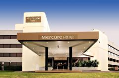
Mercure Penrith - Penrith 
From: A$279 More Info... |

Rouse Hill
Rouse Hill Map
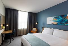
 Multiple Hotels
  Hotel
Hotel 

