Brim Accommodation, Hotels, Tours & Information
Places nearby Brim
- Angip
- Annuello
- Areegra
- Aubrey
- Bael Bael
- Baker
- Ballapur
- Bambill
- Bangerang
- Bannerton
- Banyan
- Baring
- Barrakee
- Batchica
- Bears Lagoon
- Beauchamp
- Benetook
- Benjeroop
- Berriwillock
- Beulah
- Beverford
- Billabong
- Bimbourie
- Birdwoodton
- Boigbeat
- Boinka
- Bolton
- Boolite
- Boorongie
- Borung
- Boulka
- Boundary Bend
- Brentwood
- Broadford
- Bronzewing
- Broughton
- Buckrabanyule
- Budgerum
- Bulga
- Bullabul
- Bunguluke
- Burroin
- Cabarita
- Cal Lal
- Cannie
- Capels Crossing
- Cardross
- Carina
- Carron
- Carwarp
- Challambra
- Chillingollah
- Chinkapook
- Chirrup
- Cocamba
- Cohuna
- Cokum
- Colignan
- Corack
- Cowangie
- Cramenton
- Crymelon
- Culfearne
- Culgoa
- Cullulleraine
- Curyo
- Danyo
- Dattuk
- Daytrap
- Dering
- Detpa
- Dinyarrak
- Donald
- Dooboobetic
- Dumosa
- Ellam
- Fairley
- Fairview
- Fernihurst
- Fiery Flat
- Fish Point
- Galah
- Galaquil
- Gama
- Gannawarra
- Glenloth
- Gonn Crossing
- Goongee
- Goschen
- Gowanford
- Goyura
- Hattah
- Haysdale
- Homecroft
- Hopetoun
- Hopevale
- Iraak
- Irymple
- Jarklin
- Jeffcott
- Jeparit
- Jil Jil
- Kalpienung
- Kangaroo Lake
- Kaniva
- Karadoc
- Karawinna
- Karween
- Kenley
- Kenmare
- Kerang
- Kiamal
- Kinnabulla
- Kinypanial South
- Koimbo
- Kooloonong
- Koondrook
- Koorkab
- Koorlong
- Korong Vale
- Koroop
- Korrak Korrak
- Kulwin
- Kunat
- Kurdgweechee
- Kurnwill
- Lah
- Lake Benetook
- Lake Boga
- Lake Buloke
- Lake Charm
- Lake Hindmarsh
- Lake Marmal
- Lalbert
- Larundel
- Lascelles
- Leeor
- Lillimur
- Lillimur South
- Linga
- Litchfield
- Long Plains
- Lorquon
- Macorna North
- Manangatang
- Massey
- Mcmillans
- Mead
- Meatian
- Mellis
- Melville Caves
- Merbein
- Merbein South
- Meringur
- Merrinee
- Mildura
- Mildura East
- Mildura South
- Mildura West
- Milnes Bridge
- Miralie
- Miram
- Mittyack
- Morkalla
- Morton Plains
- Mulcra
- Murrabit
- Murray Downs
- Murraydale
- Murrayville
- Myall
- Mysia
- Mystic Park
- Nandaly
- Nangiloc
- Narraport
- Narrewillock
- Narrung
- Natya
- Neds Corner
- Netherby
- Ngallo
- Nichols Point
- Ninda
- Nine Mile
- Ninyeunook
- Normanville
- Nowie North
- Nowingi
- Nullawil
- Nunga
- Nyah
- Nyah West
- Nyamville
- Nyarrin
- Nypo
- Oakvale
- Ouyen
- Patchewollock
- Pella
- Pental Island
- Peppers Plains
- Perenna
- Piangil
- Pier Millan
- Pine View
- Pira
- Pirlta
- Pompapiel
- Powlett Plains
- Prooinga
- Pullut
- Quambatook
- Rainbow
- Red Cliffs
- Reedy Dam
- Richmond Plains
- Robinvale
- Rosebery
- Rowland
- Rownack
- Sandhill Lake
- Sandsmere
- Sea Lake
- Serpentine
- Speed
- Speewa
- Stewart
- Sunnycliffs
- Sunset
- Swan Hill
- Swan Hill North
- Swan Hill Pioneer
- Tarrango
- Tarranyurk
- Teal Point
- Teddywaddy
- Telopea Downs
- Tempy
- Thalia
- Thurla
- Tiega
- Timberoo
- Timberoo South
- Tittybong
- Torrita
- Towaninny
- Tresco
- Tresco West
- Trinita
- Tudor
- Tunart
- Turriff
- Tutye
- Tyntynder Central
- Tyrrell Downs
- Ultima
- Underbool
- Vinifera
- Wagant
- Waitchie
- Walpeup
- Wargan
- Warne
- Warracknabeal
- Watchem
- Watchupga
- Wedderburn
- Wedderburn Junction
- Wemen
- Werrap
- Werrimull
- Westby
- Whirily
- Wilkur
- Wilkur South
- Willah
- Willangie
- Willenabrina
- Winlaton
- Winnambool
- Wood Wood
- Woomelang
- Woorinen
- Woorinen South
- Woornack
- Wooroonook
- Woosang
- Wychitella
- Wymlet
- Yaapeet
- Yanac
- Yarraby
- Yarrara
- Yarrock
- Yarto
- Yatpool
- Yearinga
- Yellangip
- Yelta
- Yeungroon
- Yungera
Brim
A whistlestop on the Henty Highway drive north from Warracknabeal to Hopetoun, the hamlet of Brim is at the heart of wheat and sheep country in the Wimmera district of western Victoria.
A man-made lake outside the town provides swimming and boating sport when the Yarriamback Creek, which rises in the Grampians well to the south, is in flow.
There is a plaque on the highway just north of the town with a section of restored fence reminding modern generations that the famous Dog Fence once crossed these parts. Built in 1883 to slow the movement of dingoes, rabbits and other vermin, the fence ran along the 36th parallel from the South Australian border to Swan Hill and was the longest wire-netting fence in the world.
A half hour drive south takes you to Warracknabeal, whose claim to the title of Cereal Capital of the Wimmera is supported by statistics which show that more grain passes through the town than any other in Victoria.
In one of the makeshift granaries is a large alcohol distillery built during World War II to produce an alternative fuel to petrol. The war ended before production could begin.
Great deals on hotels in Murray Outback...

|
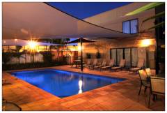
Best Western Chaffey International Motor Inn - Mildura 
From: A$189 More Info... |
|
Mercure Hotel Mildura - Mildura 
From: A$156 More Info... |
Brim Map
 Multiple Hotels
  Hotel
Hotel 

