Blakehurst Accommodation, Hotels, Tours & Information
Places nearby Blakehurst
- Alexandria
- Alfords Point
- Allawah
- Ambarvale
- Arncliffe
- Audley
- Bald Face
- Bangor
- Banksia
- Banksmeadow
- Bankstown
- Bankstown East
- Bankstown North
- Barden Ridge
- Bardwell Park
- Beaconsfield
- Belmore
- Belmore South
- Beverley Park
- Beverly Hills
- Bexley
- Bexley North
- Bexley South
- Bonnet Bay
- Botany
- Bow Bowing
- Bradbury
- Brighton-Le-Sands
- Brownlow Hill
- Bundeena
- Burraneer
- Buxton
- Camden
- Camden East
- Camden South
- Campbelltown
- Campbelltown North
- Camperdown
- Canterbury
- Caravan Head
- Caringbah
- Carlton
- Carss Park
- Chifley
- Clemton Park
- Como
- Como West
- Connells Point
- Couridjah
- Cronulla
- Daceyville
- Darlington
- Denham Court
- Dolans Bay
- Dolls Point
- Dulwich Hill
- Eagle Vale
- Earlwood
- Eastlakes
- Edmondson Park
- Ellis Lane
- Engadine
- Enmore
- Eschol Park
- Gilead
- Glen Alpine
- Glenfield
- Glenlee
- Glenmore
- Grasmere
- Grays Point
- Gymea
- Gymea Bay
- Hammondville
- Harrington Park
- Heathcote
- Hillsdale
- Holsworthy
- Hurstville
- Hurstville Grove
- Hurstville South
- Illawong
- Jannali
- Kangaroo Point
- Kareela
- Kingsford
- Kingsgrove
- Kingsway West
- Kirkham
- Kirrawee
- Kogarah
- Kogarah Bay
- Kurnell
- Kyeemagh
- Kyle Bay
- La Perouse
- Lakemba
- Lakemba South
- Lakesland
- Leppington
- Leumeah
- Lilli Pilli
- Little Bay
- Loftus
- Lucas Heights
- Lugarno
- Lugarno North
- Lurline Bay
- Macquarie Fields
- Maianbar
- Malabar
- Manly West
- Maroubra
- Maroubra Bay
- Maroubra Junction
- Maroubra South
- Marrickville
- Marrickville South
- Marrickville West
- Mascot
- Matraville
- Menai
- Menangle
- Menangle Park
- Milperra
- Minto Heights
- Miranda
- Monterey
- Moorebank
- Mortdale
- Mowbray Park
- Narellan
- Narellan Vale
- Narwee
- Nattai
- Nattai River
- Newtown
- Oakdale
- Oatley
- Oatley West
- Oyster Bay
- Pagewood
- Peakhurst
- Peakhurst South
- Penshurst
- Phillip Bay
- Picnic Point
- Picton
- Pleasure Point
- Port Botany
- Port Hacking
- Ramsgate
- Razorback
- Regents Park
- Revesby
- Revesby Heights
- Revesby North
- Riverwood
- Rockdale
- Rosebery
- Roselands
- Rosemeadow
- Royal National Park
- Ruse
- Sandringham
- Sandy Point
- Sans Souci
- Smeaton Grange
- South Belmore
- St Andrews
- St Helens Park
- St Peters
- Sutherland
- Sydenham
- Sydney Airport
- Sylvania
- Sylvania Waters
- Tahmoor
- Taren Point
- Tempe
- The Oaks
- Theresa Park
- Thirlmere
- Turrella
- Undercliffe
- Varroville
- Voyager Point
- Warumbul
- Waterloo
- Wattle Grove
- Wedderburn
- Werombi
- Wiley Park
- Wolli Creek
- Woodbine
- Woolooware
- Woronora
- Woronora Heights
- Yarrawarrah
- Yowie Bay
- Zetland
Blakehurst
Flanked by the waters of Kyle Bay and Kogarah Bay, Blakehurst is part of the Georges River municipality of Kogarah.
Taking its name from the local Aboriginal term for 'place of reeds', Kogarah, 15km south of the Sydney CBD, was first settled in the 1860s, but its development was triggered by the opening of the rail line through the district to Hurstville in 1884.
Several buildings in the municipality such as the School of Arts and the original post office, now a Community Aid Centre, date back to the 19th century, while the Greek Orthodox Church, built in 1981, adds a classic touch of Neo Byzantine to the Kogarah streetscape.
Jubilee Oval was home to St George when the Dragons were such a dominant force in the Sydney Rugby League premiership.
Over recent years, the Kogarah Town Centre has lost part of its soul as the growth of commerce and educational facilities have forced residents out of the area. At the dawn of the new millennium less than 400 people lived in the centre which attracted 7000 workers, 3000 TAFE and 3000 school students every working day. The council has implemented a plan to increase the number of permanent residents by at least 2000 and to attract more people oriented services into the town centre.
Great deals on hotels in Sydney South and Airport...
|
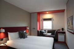
Best Western Plus Camperdown Suites - Camperdown 
From: A$196 More Info... |
|
ibis Sydney Airport - Mascot 
From: A$149 More Info... |
|
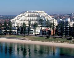
Novotel Sydney Brighton Beach - Brighton-Le-Sands 
From: A$288 More Info... |
|
Novotel Sydney International Airport - Wolli Creek 
From: A$219 More Info... |
|
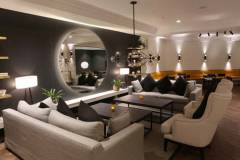
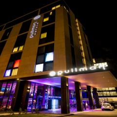
Pullman Sydney Airport - Mascot 
From: A$268 More Info... |
Blakehurst Map
 Multiple Hotels
  Hotel
Hotel 

