Earlwood Accommodation, Hotels, Tours & Information
Places nearby Earlwood
- Alexandria
- Alfords Point
- Allawah
- Ambarvale
- Arncliffe
- Audley
- Bald Face
- Bangor
- Banksia
- Banksmeadow
- Bankstown
- Bankstown East
- Bankstown North
- Barden Ridge
- Bardwell Park
- Beaconsfield
- Belmore
- Belmore South
- Beverley Park
- Beverly Hills
- Bexley
- Bexley North
- Bexley South
- Blakehurst
- Bonnet Bay
- Botany
- Bow Bowing
- Bradbury
- Brighton-Le-Sands
- Brownlow Hill
- Bundeena
- Burraneer
- Buxton
- Camden
- Camden East
- Camden South
- Campbelltown
- Campbelltown North
- Camperdown
- Canterbury
- Caravan Head
- Caringbah
- Carlton
- Carss Park
- Chifley
- Clemton Park
- Como
- Como West
- Connells Point
- Couridjah
- Cronulla
- Daceyville
- Darlington
- Denham Court
- Dolans Bay
- Dolls Point
- Dulwich Hill
- Eagle Vale
- Eastlakes
- Edmondson Park
- Ellis Lane
- Engadine
- Enmore
- Eschol Park
- Gilead
- Glen Alpine
- Glenfield
- Glenlee
- Glenmore
- Grasmere
- Grays Point
- Gymea
- Gymea Bay
- Hammondville
- Harrington Park
- Heathcote
- Hillsdale
- Holsworthy
- Hurstville
- Hurstville Grove
- Hurstville South
- Illawong
- Jannali
- Kangaroo Point
- Kareela
- Kingsford
- Kingsgrove
- Kingsway West
- Kirkham
- Kirrawee
- Kogarah
- Kogarah Bay
- Kurnell
- Kyeemagh
- Kyle Bay
- La Perouse
- Lakemba
- Lakemba South
- Lakesland
- Leppington
- Leumeah
- Lilli Pilli
- Little Bay
- Loftus
- Lucas Heights
- Lugarno
- Lugarno North
- Lurline Bay
- Macquarie Fields
- Maianbar
- Malabar
- Manly West
- Maroubra
- Maroubra Bay
- Maroubra Junction
- Maroubra South
- Marrickville
- Marrickville South
- Marrickville West
- Mascot
- Matraville
- Menai
- Menangle
- Menangle Park
- Milperra
- Minto Heights
- Miranda
- Monterey
- Moorebank
- Mortdale
- Mowbray Park
- Narellan
- Narellan Vale
- Narwee
- Nattai
- Nattai River
- Newtown
- Oakdale
- Oatley
- Oatley West
- Oyster Bay
- Pagewood
- Peakhurst
- Peakhurst South
- Penshurst
- Phillip Bay
- Picnic Point
- Picton
- Pleasure Point
- Port Botany
- Port Hacking
- Ramsgate
- Razorback
- Regents Park
- Revesby
- Revesby Heights
- Revesby North
- Riverwood
- Rockdale
- Rosebery
- Roselands
- Rosemeadow
- Royal National Park
- Ruse
- Sandringham
- Sandy Point
- Sans Souci
- Smeaton Grange
- South Belmore
- St Andrews
- St Helens Park
- St Peters
- Sutherland
- Sydenham
- Sydney Airport
- Sylvania
- Sylvania Waters
- Tahmoor
- Taren Point
- Tempe
- The Oaks
- Theresa Park
- Thirlmere
- Turrella
- Undercliffe
- Varroville
- Voyager Point
- Warumbul
- Waterloo
- Wattle Grove
- Wedderburn
- Werombi
- Wiley Park
- Wolli Creek
- Woodbine
- Woolooware
- Woronora
- Woronora Heights
- Yarrawarrah
- Yowie Bay
- Zetland
Earlwood
Bordered on the north by the Cooks River and its flanking green belt, Earlwood is a well-established, residential area on the inner south-western fringes of Sydney.
Its solid old homes testify to the orderly development and lifestyle typical of this part of the metropolitan area, but the locals did get a little heated a few years back when the developers of the huge shopping complex at Birkenhead Point just a few kilometres north on the inner harbour tried to filch Earlwood's historic, 1856-model post box.
Earlwood resolve won the day and the distinctive, bell-shaped post box remains collecting local mail just down the road from the local library.
The Cooks River is one of the most important waterways in urban Sydney and, from its rise in Bankstown to its entry into Botany Bay, it drains an area of 103sq km - an area in which almost half a million people live and which hosts 20,000 commercial and industrial premises.
More than 150 years of thoughtless dumping has also left it one of the most polluted and degraded river systems in the land.
The big clean up, however, has already begun with the 13 councils which border the river together with the State Government and a host of volunteer organisations all committed to improving and filtering the stormwater and to policing industrial and commercial housekeeping.
Great deals on hotels in Sydney South and Airport...
|
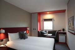
Best Western Plus Camperdown Suites - Camperdown 
From: A$201 More Info... |
|
ibis Sydney Airport - Mascot 
From: A$187 More Info... |
|
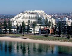
Novotel Sydney Brighton Beach - Brighton-Le-Sands 
From: A$316 More Info... |
|
Novotel Sydney International Airport - Wolli Creek 
From: A$228 More Info... |
|
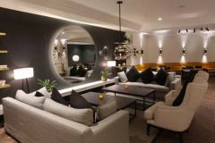
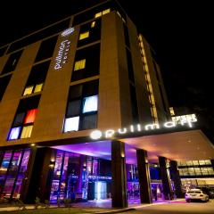
Pullman Sydney Airport - Mascot 
From: A$269 More Info... |
Earlwood Map
 Multiple Hotels
  Hotel
Hotel 

