Violet Town Accommodation, Hotels, Tours & Information
Places nearby Violet Town
- Appin
- Arcadia
- Ardmona
- Avenel
- Avonmore
- Baddaginnie
- Bailieston
- Bald Rock
- Ballendella
- Balmattum
- Bamawm
- Barep
- Barmah
- Barmah Town
- Barraport
- Barwo
- Bearii
- Benarch
- Boho South
- Boxwood
- Branditt
- Break Of Day
- Bunbartha
- Buxton
- Byrneside
- Calivil
- Canary Island
- Canary Island South
- Caniambo
- Carag Carag
- Cathkin
- Catumnal
- Caveat
- Cobram
- Cobram Barooga
- Cobram East
- Colbinabbin
- Colbinabbin West
- Colliver
- Congupna
- Cooma
- Corop
- Cosgrove
- Cosgrove South
- Creek Junction
- Creek View
- Creighton
- Creightons Creek
- Devenish
- Dhurringile
- Diggora West
- Dingee
- Dingwall
- Dookie
- Dookie College
- Dropmore
- Drumanure
- Drummartin
- Dunbulbalane
- Dunkirk
- Durham Ox
- Earlston
- Echuca
- Echuca South
- Echuca Village
- Eldorado
- Elmore
- Euroa
- Fairy Dell
- Fawcett
- Flowerdale
- Ghin Ghin
- Gillieston
- Girgarre
- Girgarre East
- Gladfield
- Glenaroua
- Gobur
- Goomalibee
- Gooram
- Goorambat
- Goulburn Weir
- Gowangardie
- Gredgwin
- Gunbower
- Harrys Creek
- Harston
- Hayanmi
- Hazeldene
- Hendersyde
- Highlands
- Homewood
- Horfield
- Hunter
- Invergordon
- Kamarooka
- Kanumbra
- Kanyapella
- Katandra
- Katandra West
- Katunga
- Keely
- Kelvin View
- Kerrisdale
- Kialla
- Kialla East
- Kialla Lakes
- Kialla West
- Killingworth
- Kithbrook
- Kobyboyn
- Koonda
- Koonoomoo
- Koriella
- Kotta
- Kotupna
- Koyuga
- Kyabram
- Lancaster
- Langville
- Leaghur
- Leitchville
- Lemnos
- Limestone
- Lockington
- Locksley
- Loddon Vale
- Longwood
- Macorna
- Major Plains
- Mangalore
- Marionvale
- Marraweeney
- Marungi
- Mathiesons
- Mayreef
- Meering West
- Merrigum
- Merton
- Miepoll
- Milloo
- Mincha
- Minmindie
- Minto
- Mitchellstown
- Mitiamo
- Moglonemby
- Molesworth
- Molka
- Mologa
- Monea
- Moorilim
- Mooroopna
- Mooroopna North West
- Muckatah
- Mundoona
- Murchison
- Murchison East
- Murchison North
- Murrindindi
- Nagambie
- Nalinga
- Nanneella
- Narioka
- Nathalia
- Nooramunga
- Northwood
- Numurkah
- Orrvale
- Patho
- Pederick
- Petersons
- Piavella
- Picola
- Pine Grove
- Pine Lodge South
- Prairie
- Puckapunyal
- Pyramid Hill
- Reedy Creek
- Riggs Creek
- Rochester
- Roslynmead
- Rubicon
- Ruffy
- Runnymede
- Rushworth
- Sandmount
- Seymour
- Seymour South
- Sheans Creek
- Shepparton
- Shepparton East
- Shepparton North
- Shepparton South
- Simmie
- Snobs Creek
- St Germains
- St James
- Stanhope
- Stewarton
- Strath Creek
- Strathallan
- Strathbogie
- Strathmerton
- Sugarloaf Creek
- Sylvaterre
- Tabilk
- Taggerty
- Tallarook
- Tallygaroopna
- Tamleugh
- Tamleugh West
- Tandarra
- Tarcombe
- Taripta
- Tarnook
- Tatura
- Tennyson
- Terip Terip
- Terrick Terrick
- Thornton
- Timmering
- Tongala
- Toolamba
- Torrumbarry
- Tragowel
- Trawool
- Tungamah
- Tyaak
- Undera
- Upotipotpon
- Waaia
- Waggarandall
- Wahring
- Wanalta
- Wanurp
- Warragamba
- Wattle Vale
- Wattville
- Wee Wee Rup
- Wharparilla
- Whiteheads Creek
- Whroo
- Willowdene
- Wirrate
- Woodbourne
- Wunghnu
- Wyuna
- Yabba North
- Yalca
- Yalca North
- Yallook
- Yambuna
- Yando
- Yarck
- Yarrawalla
- Yarrawonga
- Yarroweyah
- Yielima
- Youanmite
- Youarang
- Yundool
- Zeerust
Violet Town
Situated on the Hume Highway, Violet Town sits at the foot of the Strathbogie Ranges and was the first inland Victorian town to be surveyed.
The site of the township was named Violet Ponds by explorer Major Thomas Mitchell who was obviously impressed by the host of native flowers growing round a pond alongside which he camped.
Although the name has since undergone a slight change, the town retains much of its original village atmosphere. The village has grown round Honeysuckle Creek and the floral theme is enhanced by such street names as Primrose, Lilac and Tulip.
The town itself is an important centre for ballooning, gliding and sky-diving and is the gateway to the scenic routes and horse-riding trails of the ranges which also boast a number of herb and deer farms. Stall-holders supporting the Violet Town Community Markets sell their varied wares on every second Saturday.
Great deals on hotels in Goulburn Valley...
|
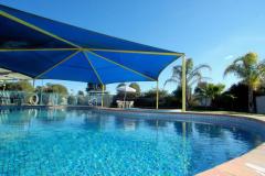
BIG4 Shepparton Park Lane Holiday Park - Kialla 
From: A$206 More Info... |
|
The Sebel Yarrawonga Silverwood - Yarrawonga
From: A$376 More Info... |
Violet Town Map
 Multiple Hotels
  Hotel
Hotel 

